


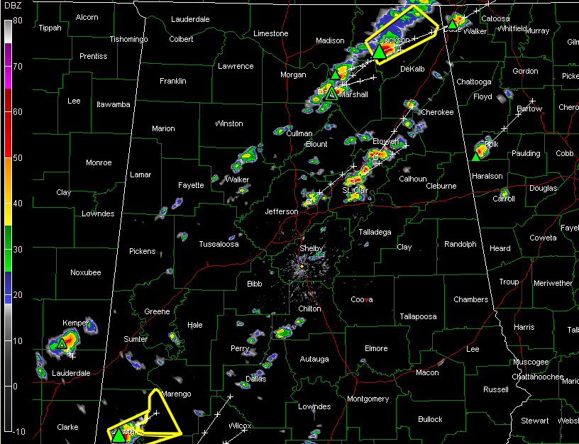
The NWS Huntsville has issued a severe thunderstorm warning for Northeast Alabama’s Jackson County. Severe storm approaching Scottsboro. Good indications of large hail with this storm.
A severe thunderstorm warning has been issued for Choctaw County in Southwest Alabama by the NWS Mobile. A new severe thunderstorm warning was just issued for Marengo County.
Storms are breaking out in a 90 mile wide band that is generally centered on I-59.
Here is the radar:
We have loud thunder here in Trussville now.
Storms have been slow to develop because of increasing mid-level temperatures that have resulted in a slower temperature drop with height. This puts a damper on the instability despite increasing low level temperatures. But now the storms seem to be overcoming that limitation. The hail threat will be significant this afternoon. There is also a threat of damaging winds with the meaner storms. Lightning and heavy rain will be a problem as well. The tornado threat has diminished even further and it was not very high to start with.



