


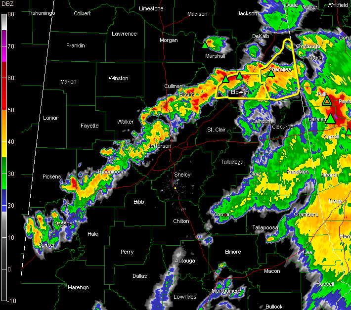
A line of showers and heavy thunderstorms now extends from Cherokee and Etowah Counties in East Alabama southwestard through Blount, western Jefferson, eastern Walker,, Tuscaloosa, southern Pickens, Greene and Sumter Counties.
Severe thunderstorm warnings continue along this line over northern Etowah and Cherokee Counties.
The storms have been packing quite a punch with hail and strong winds, but should begin to weaken over the next couple of hours as the upper level support departs to the northeast and we start to lose the heat of the day.
A severe thunderstorm watch continues until 6 p.m. for much of Central and Northeast Alabama. Scroll down for counties.
Some late reports from the NWS Chat…
WZZK’s Mike Miller reports that Jeffco Sheriffs report tree down across road on Tyler Loop Road at Stone Arbor Drive.
Pea sized hail and 40-50 mph winds reported in West Jefferson. Lots of lightning.
Golf ball sized hail reported 4 miles NNE of Hokes Bluff in Etowah County at 4:15.
Amateur radio reports trees snapped off near Centre in Cherokee County at 4:36 p.m. Winds estimated 60 mph.



