


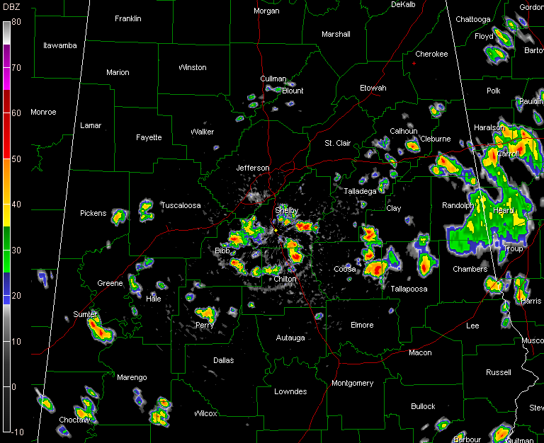
A boundary lying across the middle of Alabama and some deeper moisture has allowed for scattered storms to develop this afternoon.
They are fairly typical summertime type storms. There have been a couple of reports of minor wind damage, including a roof torn off carport at Goodwater in Coosa County. That was just before 2:30. West Shelby FD was dispatched to 12377 Hwy 17 on a tree down blocking the road….tree has been cleared now…this was just before 3 p.m. Thanks to our resident scanner monitor John Talbot for providing those reports.
On radar, you can see the stroms…from Calhoun and Cleburne Counties through Talladega, Clay, Coosa and Tallapoosa Counties. The a cluster in Bibb, Shelby and Chilton Counties.
One developing storm is over Northwest Tuscaloosa County. Ron Hughes reports thundera nd lightning in Coker. This storm might rain itself out before it makes Tuscaloosa/Northport and even the airport. He reports 0.18 inches of rain at 3:25. His temperature dropped 9 degrees.
Other small, fairly isolated storms are scattered over Pickens, Greene, Hale, Sumter and Perry Counties.
No warnings at this moment. The stronger storms are capable of strong gusty winds of 40-50 mph. They all contain deadly lightning and brief heavy rain. Some hail could fall as well.



