


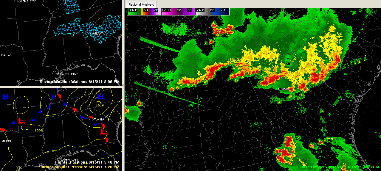
Strong to severe thunderstorms continue across Northeast Mississippi and the Tennessee Valley of North Alabama tonight.
Severe thunderstorm warnings are in effect for the Tennessee Valley of North Alabama. DeKalb County has a new severe thunderstorm warning until 8:30 p.m. for a strong storm between Henagar an Valley Head. Other warnings are upstream in Northeast Mississippi. A severe thunderstorm watch is in effect until 9 p.m. for the Tennessee Valley of North Alabama.
Vic Bell reports dime sized hail at Black Creek in northern Etowah County with winds gusting to 40 mph.
A 59 mph wind gust was reported at Muscle Shoals at 7:38 p.m.
The main storms extend from north of Ripley to north of Booneville to north of Tishomingo in Northeast Mississippi, on into Northwest Alabama from Cherokee to Florence to Lexington and then into Tennessee.
A couple of scattered storms have formed back to the southwest, approaching Union county (near New Albany).
This activity is pushing east/southeast at 20 mph.
In Northeast Alabama, strong storms were over southeastern Madison, southern Jackson Counties. These storms are moving east and east/northeast.
The NWS Huntsville just issued a Severe Thunderstorm Warning for Colbert, Lauderdale, Lawrence, Limestone, Madison, Morgan [AL] till 8:30 PM CDT
The culprit is a trough and upper level disturbance now moving through Northwest Alabama and a stationary front extending southeastward from Middle Tenneessee through Northeast Alabama into Georgia.
The activity will continue to drop southeastward. The main areas affected by the Tennessee Valley storms will extend down into Cullman and eventually Blount Counties. If it holds together, it will get into East Alabama.
The Northeast Mississippi storms will affect areas generally along and east of Corridor X (I-22).
West of that, scattered strong storms will occur.
There is decent instability (2000-3000 j/kg) over Northwest and North Central Alabama, along with just enough wind shear to let the storms stay organized (20-25 kts). Not the kind of wind shear that causes tornadoes, but the kind that keeps the storms from raining themselves out.
So, the storms should continue for a few more hours, slowly going downhill as we lose the intense heating of the day. Until then, they will produce strong, gusty winds, perhaps as high as 60 mph, hail to the size of quarters, along with very heavy rain and intense lightning.
BTW…it was 98F at Birmingham, tying the record for the date.



