


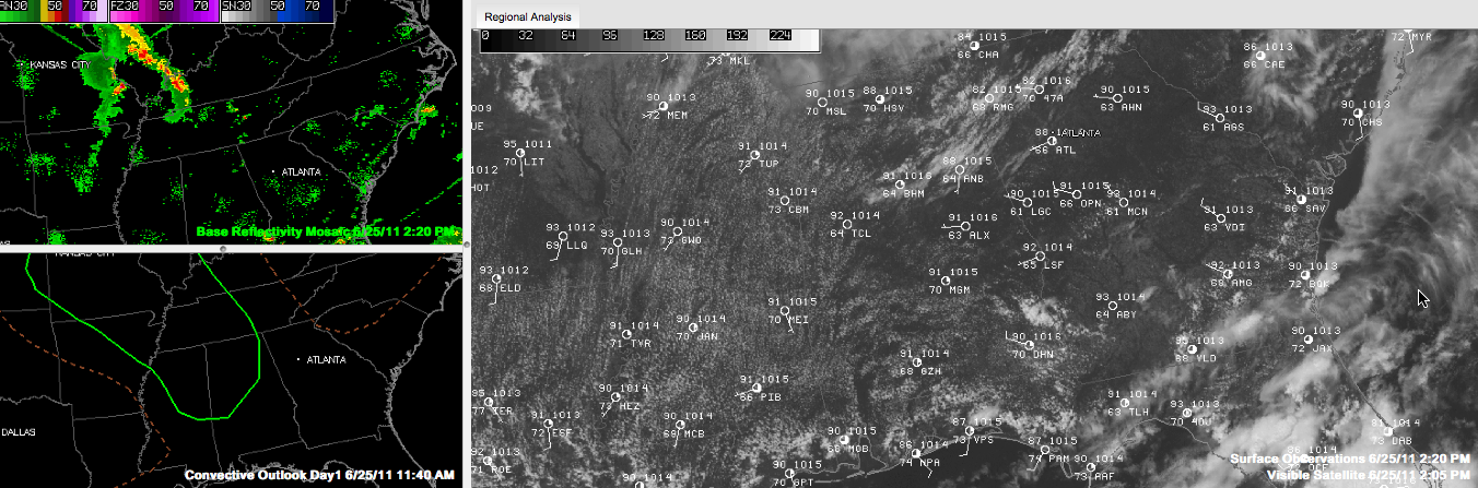
A fine summertime Saturday is in progress across Alabama today with partly cloudy skies and warm temperatures.
Readings were in the lower 90s at 2 p.m. and will settle out between 92F at 95F across the area before they start to recede for the night. It was only 86F at Anniston, where clouds have been a little thicker.
Radars are mostly clear for now. A few showers were trying to form over Northeast Alabama, but they have had a hard time establishing a beachhead. The SPC still thinks we could see strong storms across the state, generally north and west of a line from Demopolis to Calera to Talladega and northward into Northeast Alabama.
The ridge of high pressure over the Southern Plains will build eastward into Alabama over the next 36 hours, limiting our shower and storm chances and keeping us on the hot and humid side.
The morning run of the GS erodes the eastern edge of the ridge by midweek, allowing a cool front to edge into the state. If this happens, we will see a little better chance of a storm in the Tuesday/Wednesday time frame. We will see.
Still indicating a tropical cyclone in the western Gulf by late in the week. It will have no impact on Alabama’s weather as it should move into northern Mexico. It could bring beneficial rains to a parched South Texas.



