


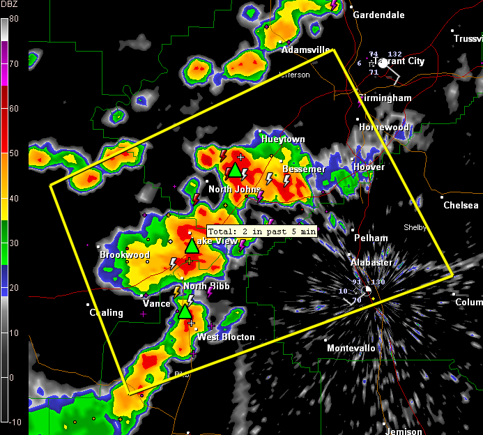
Active thunderstorms are quite strong over extreme northeastern Tuscaloosa, southwestern Jefferson and northern Bibb Counties.
A severe thunderstorm warning remains in effect until 3:45 p.m. for these counties and northwestern Shelby as well.
Storms have exploded from Bessemer western to north of North Johns and storms are quite intense in the Lake View and West Blocton areas.
These storms will intensify further as an old outflow boundary blows past them over the next few minutes.
Richard Viola reports 0.91″ in one hour at Lake View. There is a good chance there could be some hail in that Lake View cell.
Storms intensifying west of Tuscaloosa have dumped 0.50″ in just 20 minutes at Coker according to Ronald Hughes.



