


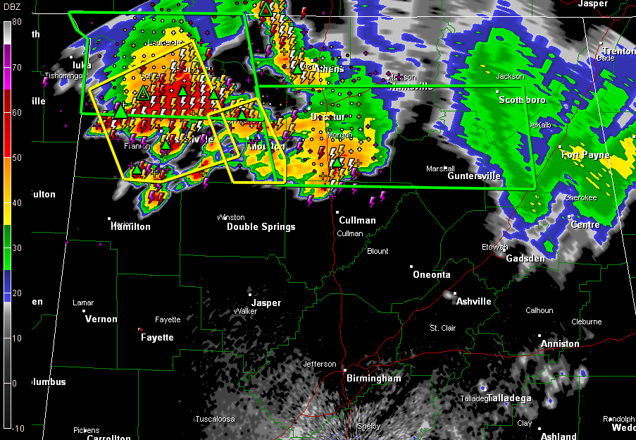
Strong thunderstorms continue to drop southeastward early this morning over Northwest and North Central Alabama.
Severe thunderstorm warnings continue from Colbert and Lauderdale Counties through Franklin, Lawrence and Morgan Counties. A tree was just reported down on a house with occupants possibly trapped in Locust Shores in Colbert County. Injuries may be involved.
The strongest cells were moving into Franklin County…with others developing over down into northeastern Marion County. Storms had intensified quickly between Bear Creek and Hackleburg.
The Weather Service is issuing a significant weather alert for Winston and Marion Counties now. This is just below a severe thunderstorm warning.
It does appear that the storms will be able to hold their intensity pretty well, and may hold together at least down through Marion/Winston/Cullman and Walker/Jefferson/Blount Counties through 5 a.m.
The main threats will be torrential rains, some hail and potentially damaging wind gusts as well as intense lightning.
The NWS has extended the severe thunderstorm watch area to include: Fayette, Lamar and Marion Counties till 5:00 AM CDT.. It remains in effect for Blount, Calhoun, Cherokee, Clay, Cleburne, Etowah, Jefferson, Randolph, Shelby, St. Clair, Talladega, Walker and Winston Counties until 5 a.m.



