


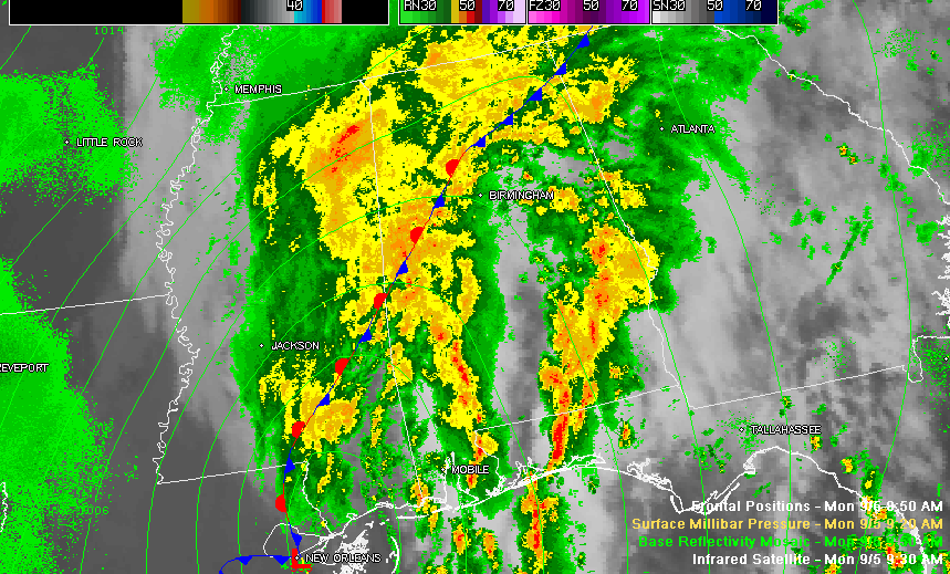
Click to enlarge the graphics.
The remnants of Lee are on the move now. The center is 120 south of Jackson MS.
Heavy rain covers the northwestern half of Alabama. There are numerous flash flood warnings, shown in the left lower panel of this this graphic below.
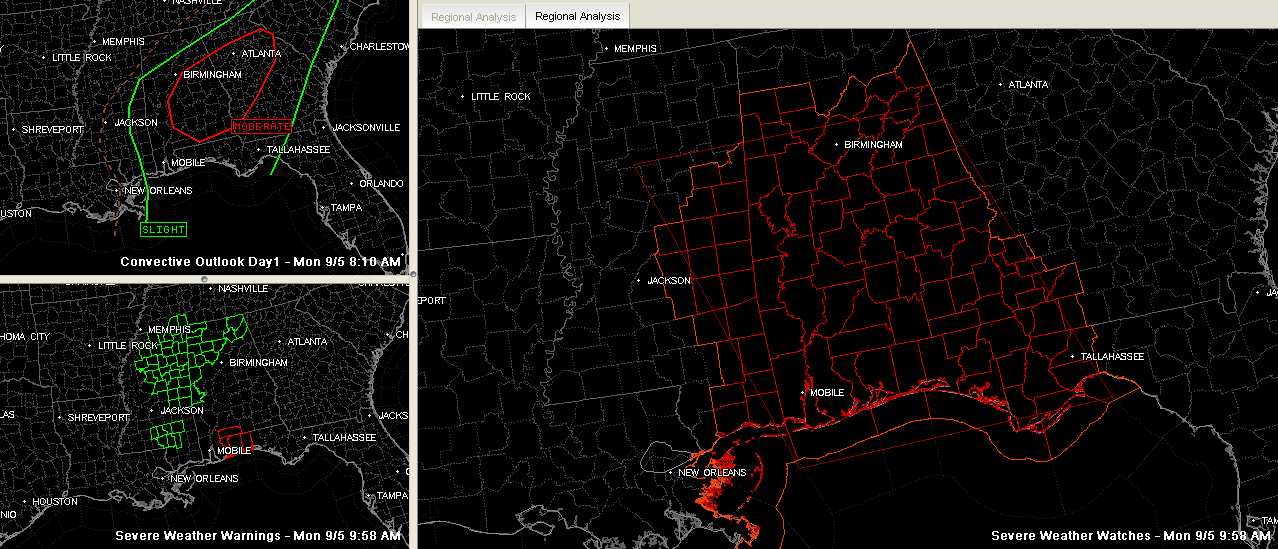
The right panel shows the tornado watch. It goes until 7 p.m. A LATE NOTE: The following counties were just cleared..Fayette, Lamar, Marion, Pickens, Walker and Winston. Those counties are northwest of the front and in more stable air. Doesn’t mean that they won’t continue to have tremendous rains, however.
Interesting to note the moderate risk outlook from the SPC for much of Alabama/Georgia in the upper left panel. That area basically encompasses a 15% chance of a tornado within 25 miles of the locations within it. The tornadoes that do occur will be of the smaller, spin up variety that are hard to detect. Can’t rule out an EF! or EF2, but most that do form will be EF0.
As much as 8 inches of rain is still expected to fall by Tuesday morning over North Alabama, with widespread 4 to 7 inch amounts over the northern half of the state as the low combines with copious moisture, a stalled front and approaching upper level disturbance to produce extensive heavy rainfall.
Breezy northeasterly and southeasterly winds ahead of the low will increase as we go through the afternoon until they are averaging 10-20 mph with higher gusts. John Talbot reports Oakman FD dispatched to reports of trees blocking the road on highway 18. Probably brought down by 25 mph wind gust thanks to the wet ground and weakened root systems from recent drought.



