


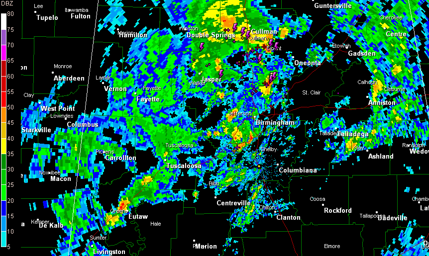
An upper level disturbance lifting out of West Central Alabama continues to trigger storms from from extreme eastern Winston through Cullman, western Blount, eastern Walker and into northern Jefferson Counties.
These first round storms are slightly weaker than they were an hour ago and they have decreased in coverage a bit.
Having said that, they could produce 40 mph winds gusts and small hail to go with lightning and heavy rain.
The strongest storm right now is near Garden City, heading up towards Blountsville. Another decent storm was just north of Pinson.
Storms have formed over southern Jefferson County, along I-459. Some lightning in Hoover. These, and all of the activity, will continue to push northeastward.
The NWS is looking at the situation closely and analyzing the atmosphere. They could trim some counties from the tornado watch based on what they think.
Slightly more unstable air with some decent wind shear will push into Alabama later this morning, ahead of a cold front and low pressure to our west and northwest. There could be a few warnings through the morning hours, especially when stronger storms over southern Mississippi and eastern Louisiana work their way northeastward over the next few hours. There are currently five tornado warnings in effect now for LA/MS.



