


Do you remember the old commercial, “Mama Mia, that’s a spicy meatball!”? It could be applied to the clearing behind today’s front. Well, not the meatball part, but you get the idea.
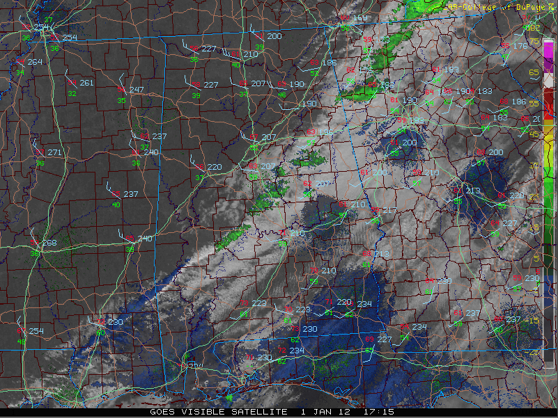
A strong Arctic front was passing quickly through Alabama on this Sunday. A weakening line of showers preceded it, but many areas got no rainfall at all.
Interestingly, the sun is coming out immediately behind the front, and temperatures actually jump briefly.
They will drop again some within the first two hours after the front, but increasing sunshine will allow them to inch back up through the afternoon. So get ready for a temperature roller coast for the next few hours.
In any case, as soon as the sun sets, the temperatures will fall into the 40s very quickly under clear skies.
Winds behind the front are gusting to 30 mph and will remain strong and gusty out of the northwest through the afternoon.
We will drop to below freezing in most locations by morning despite the fact that the northwesterly wind will persist all night. It won’t be as strong as it is this afternoon, but it will keep the atmosphere mixed and will keep the cold air from settling out near the surface and temperatures from bottoming out.
Monday will feature highs in the 40s and many spots might not get out of the 30s Tuesday.



