


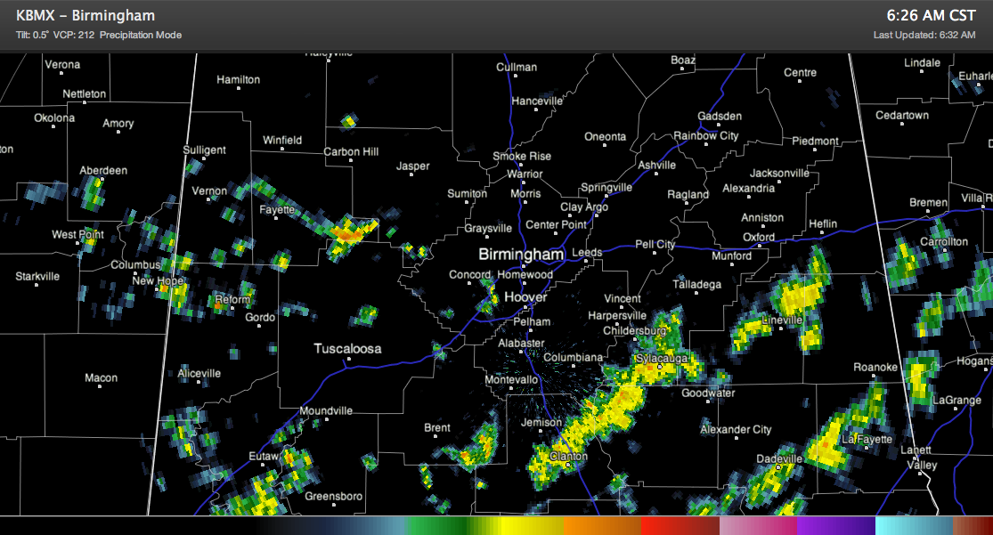
A few showers are occurring across Central Alabama this morning as a ripple in the upper flow passes over the state. Other showers are massing over northern Mississippi and western Tennessee ahead of a southeastward moving cold front.
Skies are partly to mostly cloudy with mild temperatures in the 50s.
The most concentrated showers extend from Chilton into Talladega and Clay Counties. A heavier shower between Berry and Oakman is part of another smaller concentration of showers over West Alabama. The activity is pushing east with the disturbance.
To the northwest, more showers are ahead of a cold front that is pushing into northwestern Tennessee. This front will push into North Alabama in the next 24 hours and stall. It will be critical to the forecast over the next 72 hours as it will trigger showers through Monday before the main system rolls through late Tuesday with showers and the chance for a few strong storms.
Highs this afternoon will rise into the middle and upper 60s with some lower 70s to the southeast of Birmingham.
Brian will be along the video shortly. Have a great day!



