


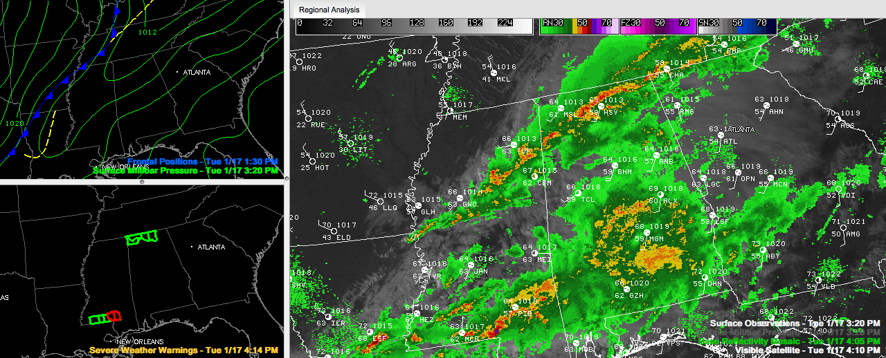
A look at radars across Alabama this afternoon shows a large area of moderate to heavy rain covering the southern half of the state. Rain and thunderstorms extend back into southern Mississippi and Central Louisiana. There are a couple of severe thunderstorm warnings west of Hattiesburg. One was just upgraded to a tornado warning around Lumberton and Purvis.
To the north, moderate to heavy rain continues over North Central Alabama over northeastern Fayette, northern Walker and Winston over into Cullman Counties. Moderate showers extend over into East Central Alabama from Oneonta and Gadsden to Piedmont and down into northern St. Clair Counties.
All of this activity is ahead of a line of heavy thunderstorms that extends from northwestern Marion across Franklin into Lawrence, Morgan and Madison Counties in North Alabama. This line extends southwestern back across Mississippi to near Winona. Lightning is indicated along the line in Alabama.
The good news is that there seems to have been a slight weakening trend in the past hour or so over North Alabama and the storms are not severe right now. But they still could become severe in isolated cases with strong wind shear and an area of very high winds at the jetstream level moving across North Alabama. Areas that are not receiving rain now ahead of the squall line have the best chance for getting severe weather.
While widespread severe weather is not expected, but a few damaging wind gusts could occur. Can’t rule out an isolated spin up tornado as well, but the chance is small. There could be some decent hail reports as well.
No severe watches are in effect right now anywhere across Alabama or the nation in fact. No convective warnings (severe thunderstorm or tornado) across Alabama right now either. There are flash flood warnings for four counties across the Tennessee Valley. We have gotten several reports of flooding across Limestone and Madison Counties.
We will continue to monitor the line of storms as it pushes southeastward across the state through the evening hours. It should reach I-59 between Gadsden and Birmingham between 6-6:30 and Tuscaloosa between 6:30 and 7.



