


The NWS has cleared Marion, Lawrence, Limestone, Madison, Morgan and Jackson Counties from Tornado Watch number 3.
The rest of North and Central Alabama continues in the watch until noon.
There is a small threat of a tornado with thunderstorms in the squall line that extends from Fort Payne in the east to Hanceville to Jasper, Fayette and on to Columbus MS. The storms in the line will also produce very heavy rain, lots of lightning, potential wind gusts to 50-60 mph and hail to the size of pennies.
Here is a shot of the current reflectivity from the BMX radar.
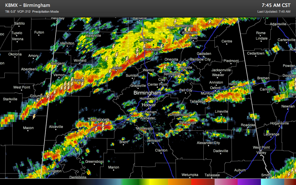
Ahead of the main line, storms have intensified in Tuscaloosa County. Lots of lightning here, could see some small hail as well. Ron Hughes in Coker reports lots of lightning to his south.
TO the east, showers and some embedded thunder is scattered across the rest of Central Alabama. There is some decent thunder up near Springville. Brenda Varner reports a nasty looking cloud approaching.
All of the storms are currently below severe limits, but as they continue edging to the southeast ahead of a cold front, they will encounter increasingly unstable air and they should intensify later this morning and this afternoon, mainly southeast of I-59.



