


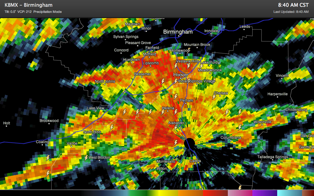
The Tuscaloosa County storm has continue to intensify as it has moved northeast up I-59/20. It now covers much of southwestern Jefferson and northwestern Shelby Counties back into Bibb County.
It is raining hard and thundering loudly in places like Helena, McCalla, Bucksville, Caffee Junction and North Bibb. It is not a good time to be on I-459 between I-59 and Exit 10. Not on I-59/20 between Tuscaloosa and Birmingham.
The activity is building northeastward and will lift across much of Shelby and much of the southeastern half of Jefferson County as well. One hour rainfall rates may approach 1.5 to 2 inches in spots, so water will pond on roadways and there could be some local flooding.
Some heavy weather in Etowah County with a merger of two thunderstorm cells west of Attalla. Areas around Gadsden, Attalla and Reece City will get lots of heavy rain and lightning.
The Jefferson/Bibb/Shelby storm is cutting off inflow to the main line and the line has weakened back to the north over Walker County. We may see the new development merge with the main line over St. Clair County. If it does, very heavy rain will result.
A tornado watch continues for Autauga, Bibb, Blount, Calhoun, Chambers, Cherokee, Chilton, Clay, Cleburne, Coosa, Dallas, Elmore, Etowah, Fayette, Greene, Hale, Jefferson, Lee, Macon, Marengo, Perry, Pickens, Randolph, Russell, Shelby, St. Clair, Sumter, Talladega, Tallapoosa, Tuscaloosa, Walker [AL] till 12:00 PM CST. The North Alabama counties have all been cleared from the watch.



