


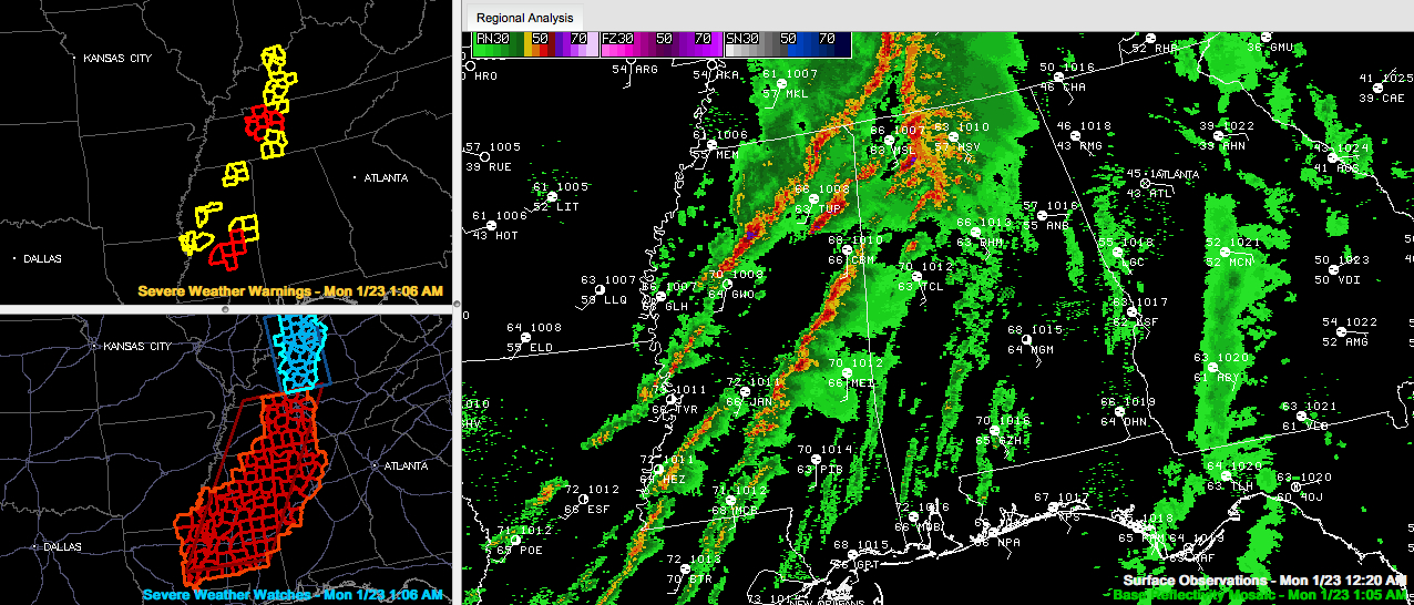
Storms are stronger over East Central Mississippi from south of Columbus to near Philadelphia to southeast of Brandon. A tornado warning continues for Rankin, Scott and Smith Counties for a possible tornado in a storm that will be approaching I-20 near Forest. There is a new circulation northeast of Forest. It is approaching Union. A new tornado warning was just issued.
These storms will impact Sumter and Pickens Counties in the next one to two hours.
Other storms are intensifying over Chickasaw, Lee and Itawamba Counties in Northeast Mississippi. These storms will affect Marion and Franklin Counties just after 1:30.
The main line of storms extends from Corinth to New Albany to northwest of Greenwood. Three severe thunderstorm warnings are in effect along and ahead of the line. These storms are a bit weaker, which is great news. Look for these storms to reach the Birmingham area by 5 a.m. or so.
The eastern Mississippi storms from Columbus to west of Meridian will reach Tuscaloosa shortly after 3 a.m. and Birmingham by 4 a.m.
No significant reports of severe weather out of Mississippi in the last 90 minutes. Lets’ hope that trend continues.
Tornado watch continues for the northwestern quarter of Alabama until 6 a.m. It is generally northwest of I-59, including Marshall, Blount, Jefferson, Tuscaloosa, Hale and Sumter Counties and counties to the northwest.
Over North Alabama, heavy rain and storms continues from Lawrence, Limesone, Winston and northwestern Walker Counties east into Madison, Morgan and Cullman Counties.
Winds are roaring across much of the northwestern quarter of Alabama, averaging 15-25 mph and gusting to 35 mph. A wind gust to 41 mph was registered at Haleyville this hour.



