


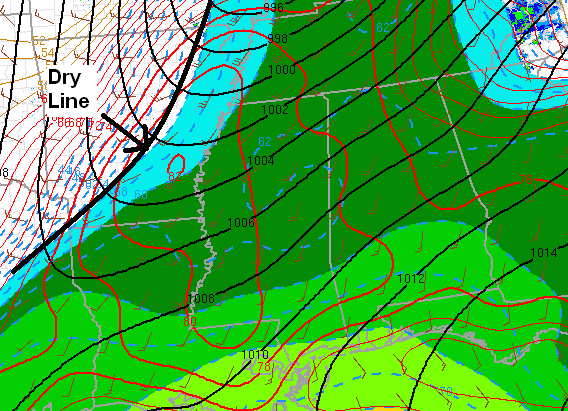
The dry line/cold front is now approaching Memphis. Over Alabama, sunshine has pushed temperatures to near 80, but this warming has, ironically, mixed a little drier air down from 3,000 feet or so, and dewpoints have dropped from 65 to 61-62. This is good.
With the very warm air and almost no cap anymore, CAPE is around 1,000 J/kg in BHM, increasing as you go north (colder air aloft up there). Wind shear is very high over a large region in this intense storm system, with helicities of 250-400 over north and central Alabama, with the highest shear to the north, closer to the surface low.
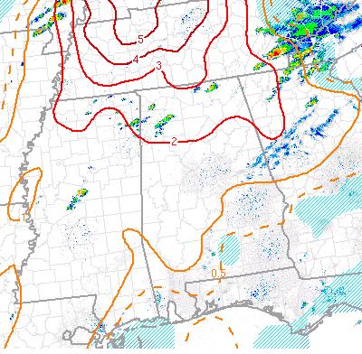
Significant tornado parameter in BHM is around 2, but it increases to 3 in HSV and 5 in Tennessee. An STP of 2 is still something to be concerned about…anything over 1 is. It does look like the main tornado outbreak will be from TN into KY (where the high risk is), given the higher shear. However, there is still a risk for tornadoes here in Alabama, especially as the afternoon and evening go on.
A few storms have started to fire in the past hour in NW AL.
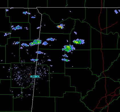
With the shear in place, any of these could become severe at any time, and could produce tornadoes.
Brian Peters and I are about to head north on I-65 to AL-157 toward Moulton. We’ll be on ustream at helenawx.



