


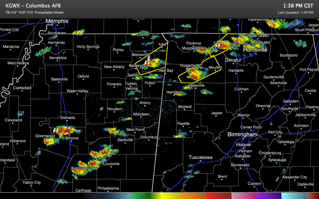
Storms have really fired up in the past hour across northern Mississippi into northwestern Alabama.
The NWS Huntsville has already posted two severe thunderstorm warnings in the past few minutes.
Memphis has just issued one for northeastern Mississippi.
And storms are firing up back to our west southwest over Central Mississippi.
The airmass over North and Central Alabama is warm and humid. Instabilities levels are moderate, running 1000-1500 j/kg. The cap is gone now. There is a good amount of speed shear. So the storms will be very organized.
The good news is that the surface winds are more out of the southwest than the southeast, and hopefully that will help to limit number of tornadoes, but we can’t count on that.
The bad news is that the storms are firing as discrete cells, meaning they can go on to become supercells, which are the most troubling. We probably will deal with the individual storms followed by a line of supercells that will push east and gradually morph into a solid line of severe storms tonight.
The threat of tornadoes and damaging winds is substantial. There could also be large hail as well.
Tornado watch goes until 9 p.m. for about the northwestern third of Alabama, generally along and northwest of I-59.
Be ready. Be safe.



