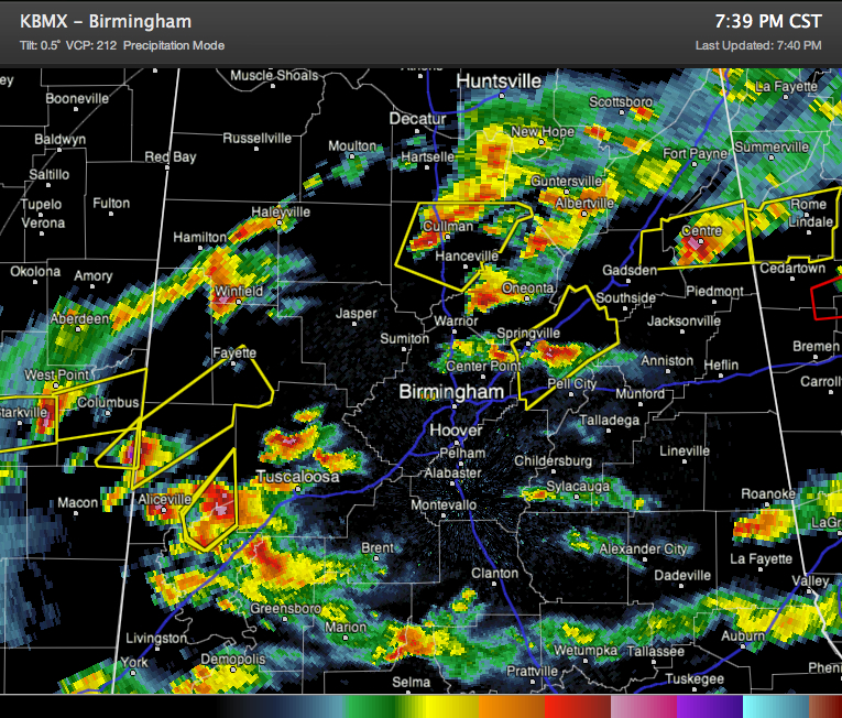
Storms are a little more organized over the past hour as stronger forcing moves in from the west and temperatures drop closer to the dewpoint. Wind shear is increasing as well thanks to a low level jet.
Fortunately, no tornado warnings right now in Central Alabama, but can’t rule out tornadoes over the next few hours. Stay alert.
Hail and damaging winds will be a threat.
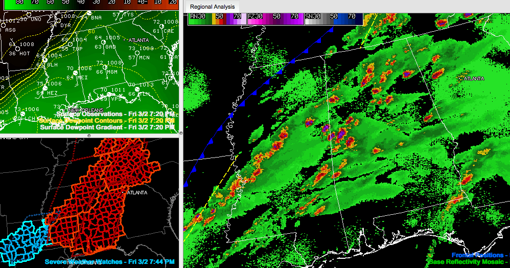
Click the image below to enlarge.
The right panel shows the radar and cold front. You can see the squall line marking the back edge of the severe weather over Central Mississippi.
Looks at the dewpoint gradient in the upper left panel.
The lower left panel shows the severe weather watches.