


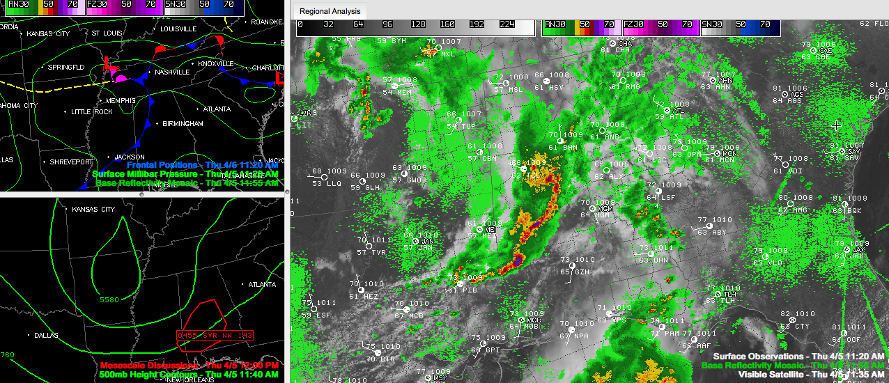
The severe thunderstorm warning for Bibb and Perry was allowed to expire at noon. The NWS has chosen to issued a significant weather outlook for Shelby, Bibb and Chilton Counties. Look out for small hail and winds to 40 mph in places like Montevallo, Alabaster, Jemison, Calera and Clanton.
The bow echo weakened as it moved into less unstable air and outran its upper air wind support.
But the southern end of the line has intensified back into Southwest Alabama, and severe thunderstorm warnings are in effect, including one for Marengo and Dallas in the Birmingham NWS area.
Storms will continue to be strongest over Southwest Alabama, where there is more heating due to breaks in the clouds. The storms over Central Alabama will hold together, but the threat for severe weather has diminished for the northern part of the area for the time being.
The National Weather Service has canceled part of the severe thunderstorm watch and reconfigured other ocunties.
The following counties have been canceled: Fayette, Greene, Hale, Jefferson, Lamar, Pickens, St. Clair, Sumter, Tuscaloosa and Walker.
These counties have been added: Barbour, Bullock, Chambers, Lee, Macon, Pike, Russell, Tallapoosa [AL] till 5:00 PM CDT
And the watch continues for Autauga, Bibb, Chilton, Coosa, Dallas, Elmore, Lowndes, Marengo, Montgomery, Perry, Shelby, Talladega [AL] till 5:00 PM CDT.
And, we’re not out of the woods yet.
The upper low is over Arkansas with a surface low north of Memphis. As colder air aloft associated with the upper low spreads eastward, the airmass over northern and Central Alabama will destabilize later this afternoon and more storms will develop. These will have the potential for some severe hail.
Storms were developing west of Memphis at the noon hour, a sign of things to come later. A new severe thunderstorm watch was just issued for northern Mississippi, eastern Arkansas and southeastern Missouri and western Tennessee.
Stay tuned.



