


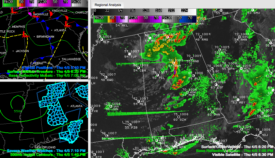
Severe thunderstorm warnings continue for:
…Jefferson, Shelby, St. Clair [AL] till 7:30 PM CDT
…Autauga, Chilton, Dallas, Elmore, Perry [AL] till 7:30 PM CDT
…northern Chilton, Shelby [AL] till 7:15 PM CDT
…Autauga, Dallas, Lowndes [AL] till 7:15 PM CDT
Thunderstorms are pounding much of North and Central Alabama this evening.
The most intense ones are…
…over eastern Jefferson and Shelby Counties…
…over northern Chilton County
…over southern Chilton back into Perry, Dallas and northern Autauga Counties.
Moderate to heavy rain covers much of Marion and Winston Counties, extending north and eastward into strong to severe storms over the Tennessee Valley, where several severe thunderstorm warnings are in effect.
Everything is pushing east at 35 mph ahead of an upper low that is swinging east southeast into Northwest Alabama.
REPORTS
…Power out in Helena at 261 and 216.
…Numerous alarm calls in Shelby County now.
…6:38 1/2 inch size hail in Fultnodale with 1 inch sized hail at 6:46 there.
…quarter sized hail reported in Alabaster at 6:46.
…half inch sized hail near Calera…reported by NWS employee



