


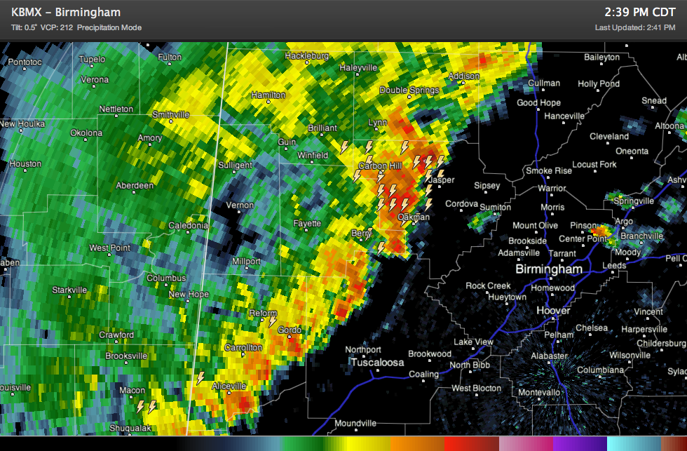
Our line of intense storms continues pushing east southeastward this afternoon across West Alabama.
It extends from eastern Winston through western Walker, eastern Fayette, northwestern Tuscaloosa and Pickens Counties.
The heaviest part of the line is in Walker County just southwest of Jasper. This lines up nicely with a CAPE max in that area (>2,500 j/kg). There is a pretty good chance that there is hail falling just northeast of Jasper.
Instability values are running 1,500-2,000 j/kg generally.
It is now about 35 miles west northwest of downtown Birmingham and 20 miles west northwest of Tuscaloosa. At 25-30 mph, it will arrive in western parts of the Birmingham Metro and Tuscaloosa in less than an hour. It should reach downtown Birmingham between 3:30 and 4. Eastern sections of Birmingham will experience it between 3:45-4:15.
The outflow will precede the main line by 10-15 minutes.
Expect winds of 30-40 mph with gusts to 50 mph as the line passes. There is lots of lightning and torrential rain.



