


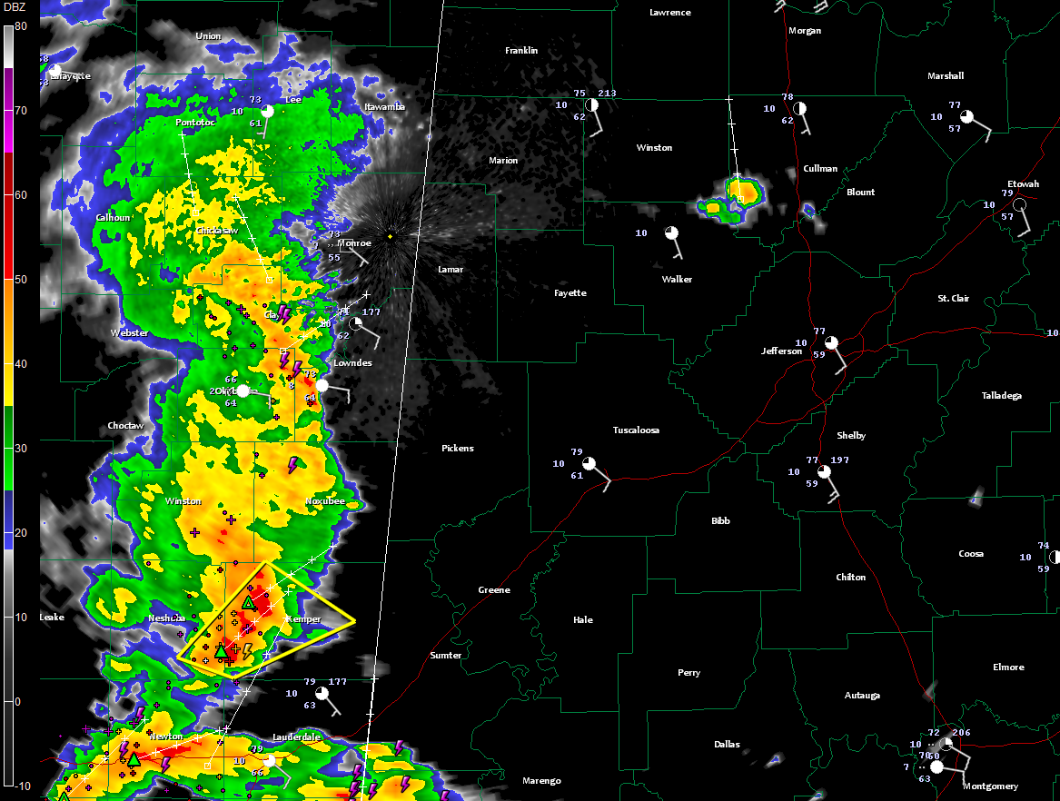
Storms are approaching the western border of Alabama at this hour.
They are less than an hour from Sumter, Pickens, Lamar and western Marion Counties.
There is a severe thunderstorm warning for Neshoba and Kemper Counties in eastern Mississippi. This storm will impact northern Sumter and Pickens Counties.
The NWS Mobile has just issued a severe thunderstorm warning for Washington County.
In Alabama, an isolated storm formed over Walker County and is now moving northnorthwest alongthe WInston/Cullman County line east of Arley. It will cross Smith Lake in the next 15-30 minutes.
The storms in eastern Mississippi will weaken as they move into Alabama since the moisture is not exceptionally high and instabilities are fairly low. But can’t rule out a warning or two through the afternoon. The main threat would be damaging winds.
You should notice the rainfall becoming more widespread as we go through the afternoon over West Central Alabama and into the I-65 corridor this evening. Rain should hold off until after 6-7 p.m. in the Birmingham metro area. It could even be a little later than that.



