


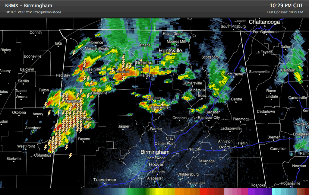
Showers and thunderstorms really intensified in the last 90 minutes ahead of a cold front that actually is still back in Mississippi.
Cooler temperatures aloft and an upper level disturbance are enhancing the storms, which had been going downhill after sunset.
But now they are producing lots of lightning, heavy rain, some small hail and gusty winds now over Northwest and West Alabama. Can’t rule out some 1 inch hail in some of the stronger storms.
The leading edge extends from Hartselle to Moulton to Haleyville to Winfield to Columbus MS.
They are pushing steadily southeastward at 15-20 mph.
They will impact Marion, Winston, northwestern Walker, Fayette, Lamar and northern Pickens Counties between now and 11:30 p.m.
They will reach Birmingham and Tuscaloosa around 1-1:30 a.m.
Storms over Cullman County have picked up in intensity. They are ahead of the main line. They will impact Blount County and could just clip extreme northeastern Jefferson County.
Other lighter showers and storms are over Northeast Alabama.
Not expecting significant severe weather, but can’t rule out marginally severe hail or a few isolated damaging wind reports.



