


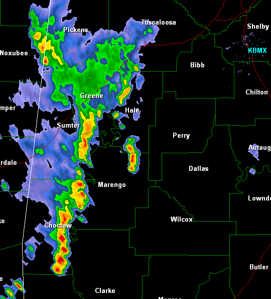
Showers and thunderstorms are slowly making their way east across west Alabama. The leading edge of the storms is from Tuscaloosa/Northport down Highway 43 to about Thomasville in Northern Clarke County. A few of these could grow strong as instability increases across the state. The rain will soon be falling in Greensboro, Demopolis and Faunsdale.
The threat of severe weather still continues today as most of Central Alabama is under a slight risk. The tornado threat remains low, but there could be very large hail and damaging straight line winds, especially as we head into tonight. We are expecting more widespread thunderstorm activity as we move into the late afternoon and our greatest chance of thunderstorm looks to be for the overnight hours. A cold front is working its way south and east today and will be the main forcing for thunderstorm development.
Improving weather for Friday and the weekend. Humidity values will back off and make it feel more pleasant.



