


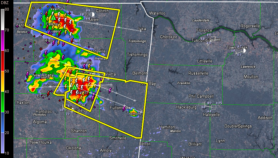
We’ve got severe thunderstorm warnings all the way to the Mississippi/Alabama border now.
Storms over northeastern Mississippi will reach Marion, Franklin, Colbert and Lauderdale Counties before 2 p.m. Warnings will likely be required.
Damaging winds is the main threat. There are also indications of 1 inch hail north of Tupelo and southwest of Corinth.
Severe weather is possible through the afternoon into this evening as far south and east as a line roughly from Eutaw to Wetumpka to Wedowee to Heflin to Scottsboro. This does include Birmingham, Tuscaloosa, Anniston and Gadsden, as well as Hamilton, DOuble Springs, Cullman, Oneonta, Ashville, Ashland, Talladega, Columbiana, Dadeville, Rockford, Clanton, Centreville, Carrollton, Fayette and Vernon.



