


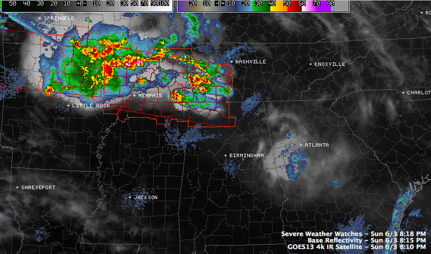
The tornado watches to our north and northwest have given everyone a little bit of a pause tonight. It’s June. We’re not supposed to have tornadoes in Alabama in June. But as we always say, when it comes to severe weather, expect the unexpected.
The NWS Birmingham is adding a low end tornado threat to their hazardous weather outlook for the overnight hours. There is just enough spin in the lower levels of the atmosphere ahead of the storms coming out of Arkansas and Tennessee.
So, we will be monitoring for a tornado threat overnight. The good news is that the airmass over Northwest Alabama down through the Birmingham area was worked over by the earlier severe weather. There is some CAPE across Northwest Alabama, but it should continue to diminish.
Keep your Weatheradios and apps on alert all night and we will have the latest throughout the night.
The NWS Memphis has several tornado warnings out right night, including one for a tornado that is about to cross the Mississippi River out of extreme Southeast Missouri into Tennessee, grazing extreme northeastern Arkansas.
The storm is near Holland. It will pass near Cooter, MO. This is north of Blytheville AR. The storm will pass near or just south of Dyersburg TN before 9 p.m. Spotters indicated that there was a tornado at 8:08 p.m. near West Hermondale. Three inch hail is indicated with this storm.
Another possible tornado was reported near Egypt AR at 8:01.



