


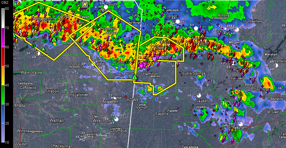
Folks across northern Mississippi and Norhwest and North Central Alabama are awakening to the sound of thunder this morning.
Storms became stronger and more organized around 3-4 a.m. from southeast of Memphis to north of Tupelo to Franklin County in Northwest Alabama to Morgan County southwest of Decatur. Severe thunderstorm warnings have been posted for Franklin and Marion Counties in Northwest Alabama and for several counties in Mississippi.
Lots of lightning and torrential rain with the storms along with the threat of large hail and damaging winds of 60 mph or so. That leading edge coming into Marion County is especially concerning as it has decent potential for wind damage or even a small spin up tornado.
The good news is that there has been a bit of a decrease in in tensity over the past hour or so.
Ahead of the main line, scattered storms have popped up from Morgan County southward through Cullman, Blount and Jefferson Counties as well. Nothing severe here for now, just lightning, loud thunder, brief heavy rain and gusty winds.



