


The severe thunderstorm warning has been canceled for West Alabama’s Tuscaloosa, Pickens and Greene Counties.
The storms have shown an overall weakening trend in the past few minutes.
Folks in the following counties will see the storms over the next 45 minutes: Bibb, Chilton, Greene, Hale, Perry, Pickens, Shelby, Tuscaloosa, Tallapoosa, Randolph and Coosa.
The strongest storms are near Mt. Cheaha in East Alabama and in Shelby County near Montevallo.
Here is a radar grab from 7:41 a.m.
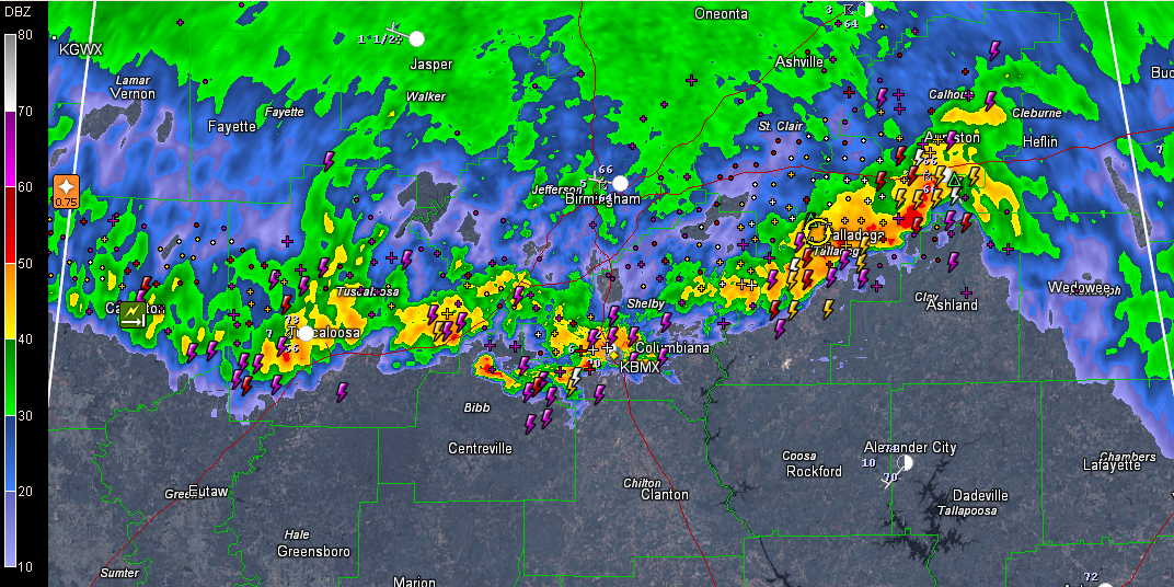
The heavier storms contain frequent lightning, gusty winds, torrential rains and small hail.
Winds gusted to 44 mph at the Birmingham Airport at 6:59 a.m. 0.34 inches of rain there through 7:31 a.m.
The big picture indicates this is the main show right now. Behind this activity, there are no thunderstorm complexes upstream that threaten Alabama. That weakening complex over western Arkansas may trigger another complex that will work down into Mississippi later today.
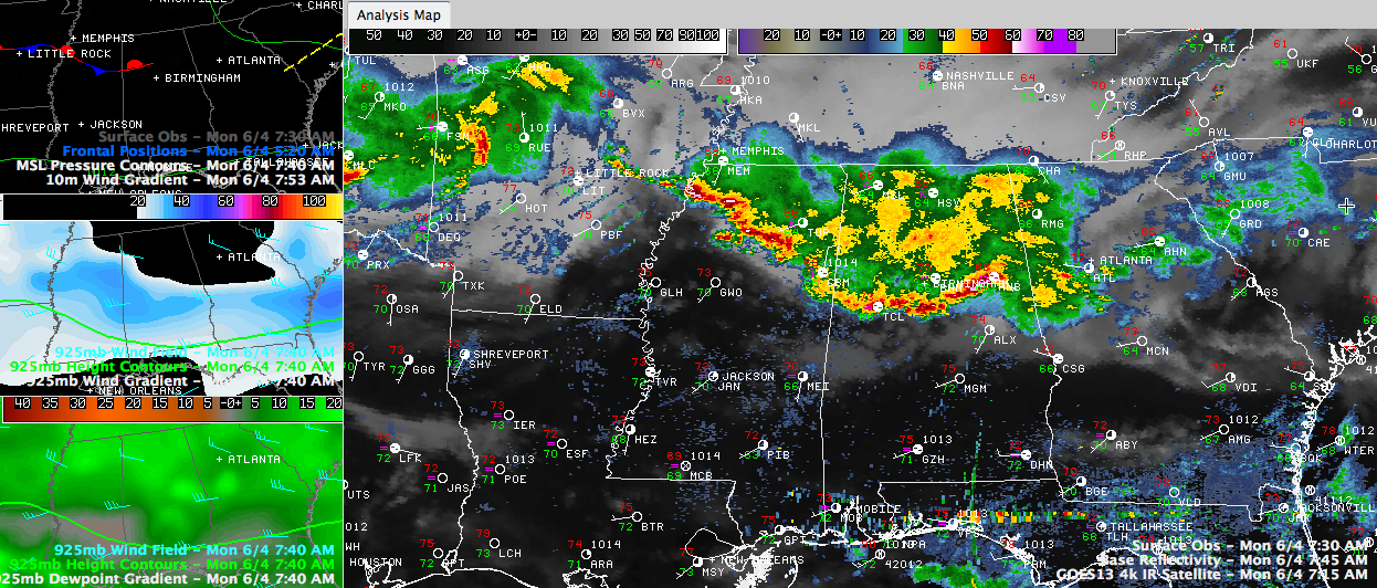
North of the thunderstorm line, much of North Central Alabama will experience light to moderate rain for a couple of hours, which is very welcome. Then we may experience a break for much of the day and into the overnight. Could see more scattered storms overnight into tomorrow morning. This is not etched in stone however, so stay tuned.
Drier air will begin to arrive Tuesday night with an extended dry period Wednesday through the weekend. It will be heating up later in the week, with highs returning to near 90F by Saturday and Sunday.



