



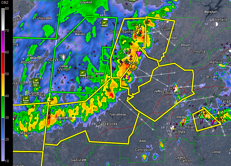
UPDATE 7:48 P.M.
Storms now into Jefferson County. Approaching North Johns, Hueytown and Adamsville. Will affect areas from Warrior/Kimberly through Gardendale/Fultondale down through the Birmingham Metro into Bessemer, Hoover and Homewood.
UPDATE 7:33 P.M.
Media reporting funnel cloud 3 miles northeast of Jasper. Corresponds well with area of rotation on radar. This is moving southeast toward Sipsey and Sumiton.
Having trouble keeping up with all the tree and power lines reports coming out of Walker County. Please take these storms seriously as they move your way.
ORIGINAL REPORT
The derecho will be entering western Jefferson County before 7:45 and will reach western parts of the Birmingham Metro around Adamsville before 8 p.m. The heaviest weather will reach downtown Birmingham shortly after 8 p.m. and eastern, southeastern and southern parts of the Metro between 8:15 and 8:30.
Widespread wind damage has been reported across West Alabama with these storms including trees down from winds over 60 mph. Power is out in many areas.
Please be in a safe place as these dangerous storms roll through. Be inside away from windows.



