


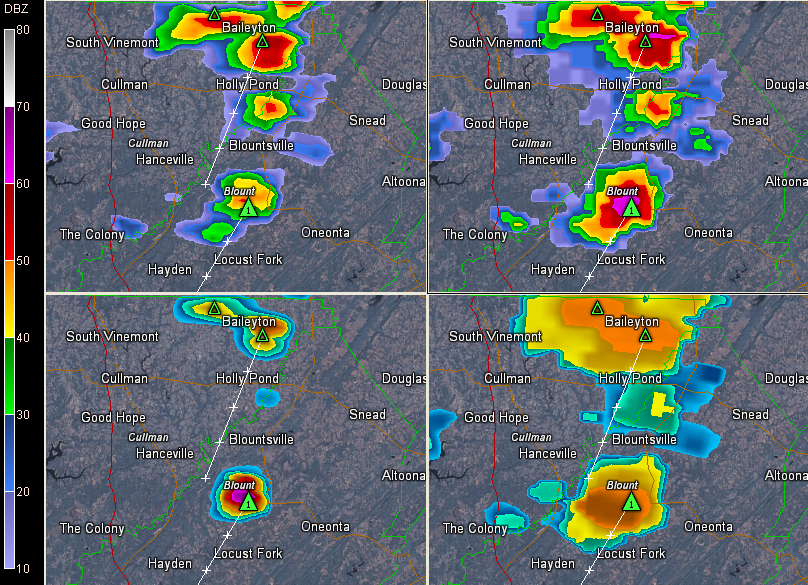
Click the image to enlarge. You will see the base reflectivity in the upper left panel. Composite reflectivity is the right panel, showing the returns from all levels seen by the radar. It shows all the precipitation suspended aloft. VIL is the lower left pane, showing large hail. The lower right panel shows the top of the storm approaching 50,000 feet.
Storms are strong over eastern Cullman County and are intensifying rapidly in Blount County.
A strong storm is building rapidly south of Blountsville, moving west southwest toward Hayden and Locust Fork.
Hail is probably getting close to the size of quarters. Damaging winds are also a good bet.



