



Storm over Cullman County from south of the City of Cullamn down to Good Hope, Hanceville and Garden City is capable of producing damaging winds and 1 inch hail.
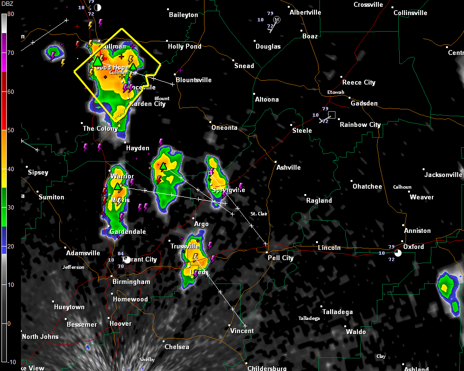
Heavy storms are over parts of Walker and Winston Counties as well. They extend from Double Spring to north of Jasper and down to Parrish and Cordova,
There are also heavy storms over northern and eastern Jefferson and St. Clair Counties.
THE NATIONAL WEATHER SERVICE IN HUNTSVILLE HAS ISSUED A
* SEVERE THUNDERSTORM WARNING FOR…
CENTRAL CULLMAN COUNTY IN NORTH CENTRAL ALABAMA…
* UNTIL 100 AM CDT
* AT 1214 AM CDT…NATIONAL WEATHER SERVICE DOPPLER RADAR INDICATED A
SEVERE THUNDERSTORM CAPABLE OF PRODUCING DESTRUCTIVE WINDS IN
EXCESS OF 70 MPH. THIS STORM WAS LOCATED NEAR HANCEVILLE…OR
ABOUT 7 MILES SOUTHEAST OF CULLMAN…AND MOVING SOUTHEAST AT 30
MPH.
* LOCATIONS IMPACTED INCLUDE…
GARDEN CITY…



