


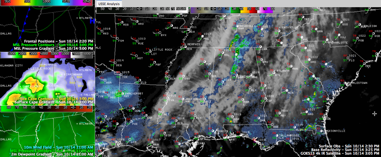
Click image to enlarge
The line of showers that pushed into West Alabama late this morning has indeed weakened, as called for by the RPM model. At 3:30 p.m., the line extends across Madison, Morgan, Cullman, eastern Walker and northwestern Jefferson Counties. It is pushing to the east and weakening. It will miss most of the Birmingham area.
More showers and storms are still expected to develop in the next few hours over Mississippi and western Alabama ahead of a cold front that is currently along a line from Little Rock to Shreveport. Instabilities have really increased just ahead of the front, so we will be watching for signs of development.
If all of this activity does develop, it should push south of the I-59 corridor by 8-9 p.m.
The SPC has removed Alabama from its Day One Severe Weather Outlook, indicating the threat of severe weather has lessened.



