



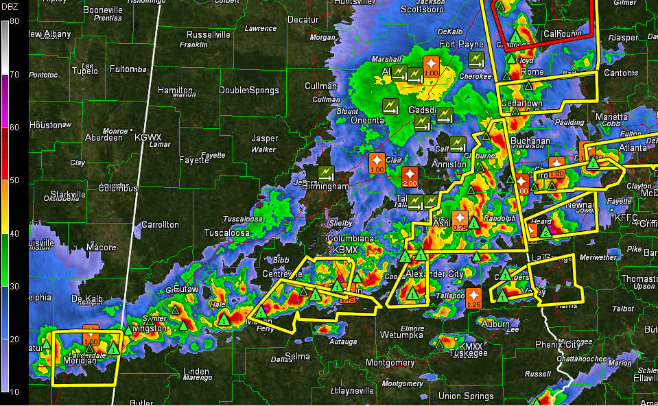
The severe weather threat is over for areas behind the line of storms including Tuscaloosa, Birmingham, Anniston and Gadsden and points north and west.
Temperatures behind the line are in the 50s to near 60F. Ahead of the line, it is 77F at Alexander City and Montgomery.
But in the wake of the storms, there are thousands and thousands of tree down and widespread power outages.
Power is out in many parts of the Birmingham metro area. Traffic is a nightmare in parts of the Metro.
The line is slowly sinking into South Central Alabama, where a new severe weather watch will be issued shortly. Here is the radar:
Several counties have just been trimmed from the watch.
These counties have been removed: Blount, Etowah, Fayette, Jefferson, Lamar, Marion, Pickens, St. Clair, Tuscaloosa, Walker, Winston [AL]
The tornado watch continues for Autauga, Barbour, Bullock, Chambers, Chilton, Clay, Coosa, Elmore, Lee, Lowndes, Macon, Montgomery, Pike, Randolph, Russell, Tallapoosa [AL] till 9:00 PM CDT
The severe thunderstorm watch continues for Bibb, Calhoun, Cherokee, Cleburne, Dallas, Greene, Hale, Marengo, Perry, Shelby, Sumter, Talladega [AL] till 9:00 PM CDT



