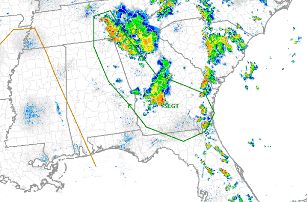
Portions of East Alabama have been included in the latest day one convective outlook issued by the SPC.
A ridge of high pressure is building in from the west. Over Georgia, strong and severe thunderstorms have been ongoing from this morning and now into the afternoon. These storms are sending out an outflow boundary into eastern Alabama. This boundary is interacting with the very warm, moist air mass and is providing enough uplift to get showers and a few thunderstorms to develop. The main threat from storms that develop today will be the chance for damaging winds. Areas to the east of Interstate 65 and stretching from Huntsville, Gadsden, Anniston, Auburn and Phenix City are included in this risk, Birmingham, Montgomery and areas to the west are not.
We will also have to monitor the area for a flooding threat as well. The showers and storms that form will be impacting the same areas that received 5-9 inches of rain Saturday morning and caused widespread flash flooding.
The risk is outlined in green on the map and once again only includes areas in East Alabama.