


Ryan Stinnett produced this morning’s forecast discussion for Brian Peters, who is traveling today in an area with poor internet connectivity. The weekend morning videos will return next week.
After another day of soaking rains in many areas yesterday, today will be an improvement. This morning there were many areas reporting patch dense fog. As we head through the morning, the fog will begin to mix out once the sun begins to heat up the surface. A dense fog advisory is in place across the entire CWA and is set to expire a 9AM.
TODAY: Most areas will see more sun than clouds once the fog mixes out. Afternoon highs will hang around the mid 80s. A few isolated storms are possible, especially the farther south you go. Any storms that develop today will be short-lived and should not pose a major threat to outdoor activities today. Enjoy today, as rain and storms will be returning to the forecast tomorrow.
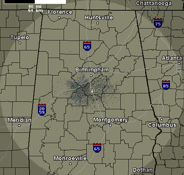
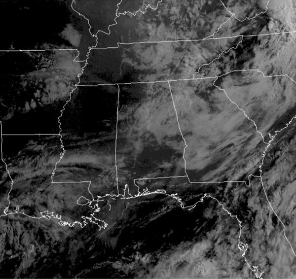
RADAR/SATELLITE CHECK: Not much going on this morning on the radar. It should stay that way today, with only a few, very widely isolated showers and storms expected today and these should be confined to our southern counties. Most of the state is seeing a mix of sun and clouds this morning. A lot of these clouds are actually the fog that developed during the overnight hours. It should be out of here the next few hours and most areas will see mostly sunny conditions.
AT THE SURFACE: A weak frontal boundary is stalled out across the southern portions of the state. The boundary will be the focal point for showers and thunderstorms across that part of the state today. Heavy rain looks to be the main concern in that region. Several areas of high pressure are in place across the Midwest and Great Lakes. Another front is moving out of the northern Rockies and into the Plains today. The frontal system will be heading to the Southeast on Sunday and Monday and will be increasing our rain chances for both days.
TROPICS: Andrea was continuing to rapidly move off to the northeast at 35mph and was centered near New York City. She will be an after thought later today, as she will be in the Canadian Maritimes by later this evening. Across the rest of the Atlantic, conditions are fairly calm. The National Hurricane Center has no area of interest and it looks as though conditions will remain calm for the next few days.
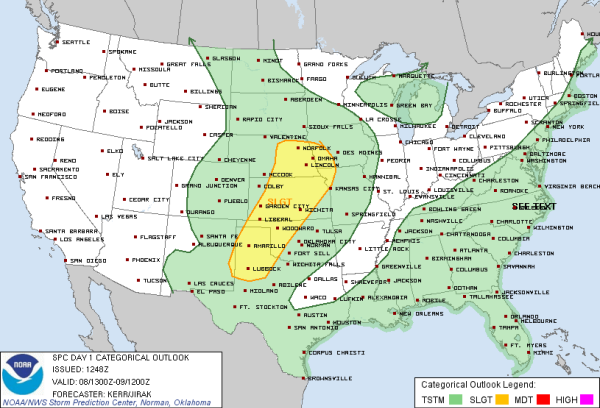
SEVERE WEATHER: The SPC has portions of the central and southern Plains outlined in a slight risk for severe weather today. Areas from the Texas Panhandle to portions of Iowa could see the chance for severe weather today as a cold front drops through the region. A few tornadoes will be possible, but the main severe weather threats will be large hail and damaging winds.
BEACH FORECAST: Typical summertime weather along the Gulf Coast this weekend. More sun than clouds and as the seabreeze kicks in, afternoon showers and thunderstorms will be possible. Afternoon highs will be in the mid 80s while overnight lows will only be in the mid 70s. Six to eight hours of sunshine are likely each day. Water temperatures are in the low 80s. Rip currents are not as bad as they were as Andrea was spinning in the Gulf, but as strong onshore flow is giving the beaches a moderate rip current threat.
HEADING INTO SUNDAY: Several shortwaves will be working across the Southeast. With the boundary to our south lifting north overnight tonight, moisture levels will once again be on the rise. With all this coming together, widespread showers and thunderstorms are back in the forecast. Skies will be mostly cloudy, and most areas could see another soaking rain. Average rainfall totals should be around one half inch, but if you are stuck under one of the storms, heavier amounts will be likely. Localized flash flooding could be a threat.



