


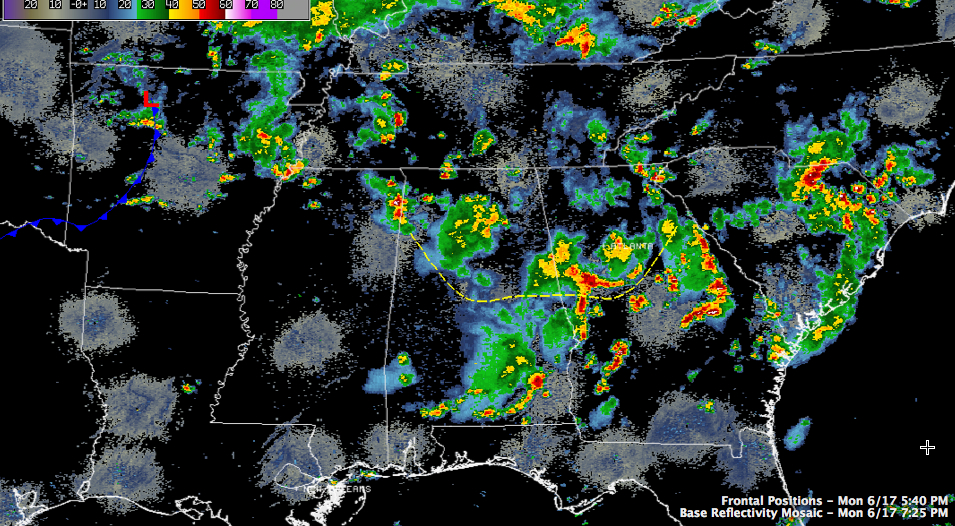
Things have calmed considerably this evening across Alabama.
A large mass of might to moderate rain covered much of Blount and Cullman Counties, with heavier rain into Marshall County.
Rain was exiting southeastern Cleburne and Randolph Counties, heading into Georgia.
Over the Northwest corner of the state, rain was falling over much of marion county, with thunderstorms over Colbert and Franklin Counties.
Everything was moving to the northeast.
Another upper level disturbance was over Louisiana and Arkansas. A surface low was over northern Arkansas with a cold front trailing into eastern Texas. Regional radars in that area were pretty quiet, but additional storms are expected to form to our west and move into Alabama later tonight. Rain chances are high through the early morning hours.
There will probably be a break at some point in the morning and then more rain and storms will form ahead of the cold front at it pushes into Alabama during the day. Current thinking is that the fornt will sink to near I-20 by sunset and put into South Central Alabama overnight. This will allow for drier air to move in for Wednesday and Thursday, putting an end to our current wet weather spell.



