


As expected, showers and storms have continued to grow along outflow boundaries that are drifting southward across Central Alabama this afternoon.
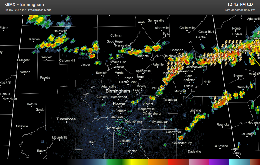
Storms are quite strong (but not severe) in northeastern St. Clair and southern Etowah County. Pea size hail was reported in Gadsden a short while ago.
They are also strong over northern Cleburne County and northern Randoplh Counties as well.
Elsewhere, showers are growing and are about to become thunderstorms from western Etowah County through Blount County north of Oneonta into Cullman and on into Winston and Marion Counties. These showers and eventual storms should continue to intensify as they spread southward.
It looks like showers and storms may not arrive in the Birmingham area before 4-5 p.m. But additional showers and storms could form earlier of course.
Be alert not only for heavy rain and deadly lightning, but strong gusty winds as well. In fact, it won’t be surprising to see a few damaging wind gusts from the stronger storms today.



