


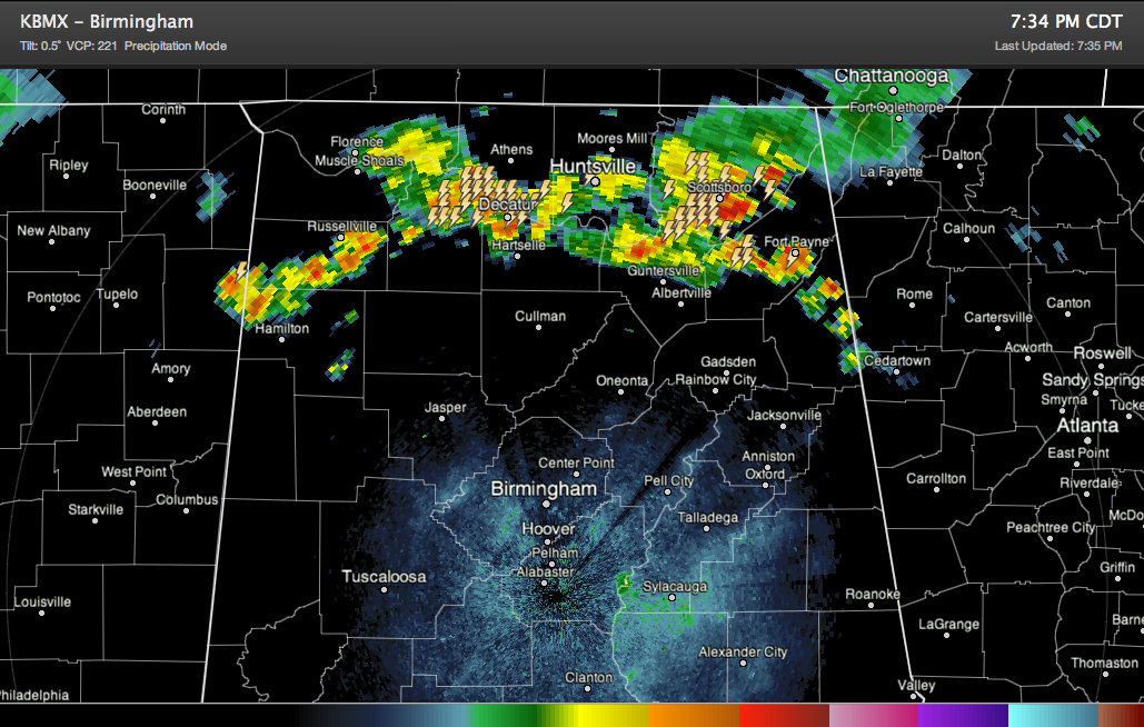
A nearly solid band of rain and thunderstorms is pushing steadily southward through the Tennessee Valley this evening ahead of a cold front. The front extends from Nashville to Memphis.
The precipitation extends from Marion and Franklin Counties to the Huntsville/Decatur area over to Scottsboro and Fort Payne.
The storms are not severe , but they do have heavy rain and intense lightning.
It will be interesting to see if they can hold together into Central Alabama. The RPM model thinks they will hold together until they get south of I-20 later tonight. That’s plausible.
They are pushing south southeast at 20 mph. They are 80 miles north northwest of the Birmingham area. This could put them in the I-20 corridor before midnight.



