


Below is the RPM model, valid at 3:30 a.m. Wednesday (after midnight tonight).
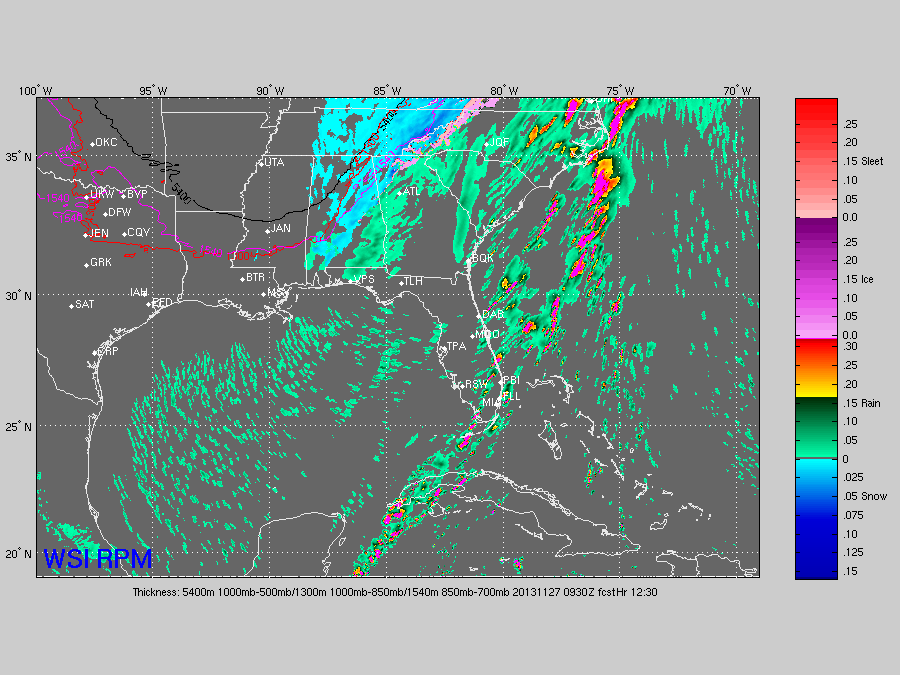
Not much change in our thinking on the snow potential tonight. Scroll down for the long story.
*The main window for snow over North and Central Alabama will come from about 11:00 p.m. until 4:00 a.m.
*Best chance of any light accumulation will be generally east of I-65, and north of I-85.
*Highest accumulation, perhaps 1/2 to 1 inch, will come over the high terrain of Northeast Alabama. Most places will see only a dusting.
*Any accumulation will be on grassy areas; the roads will stay just wet.
*Temperatures will drop below freezing after 3:00 a.m., and some patches of ice are very possible on bridges and overpasses. Not because of the snow, but because of standing water left over from the big rain event.
The upper level feature that will bring the chance of snow is approaching Alabama from the west. These can bring a surprise or two, so we will watch radar trends closely.



