


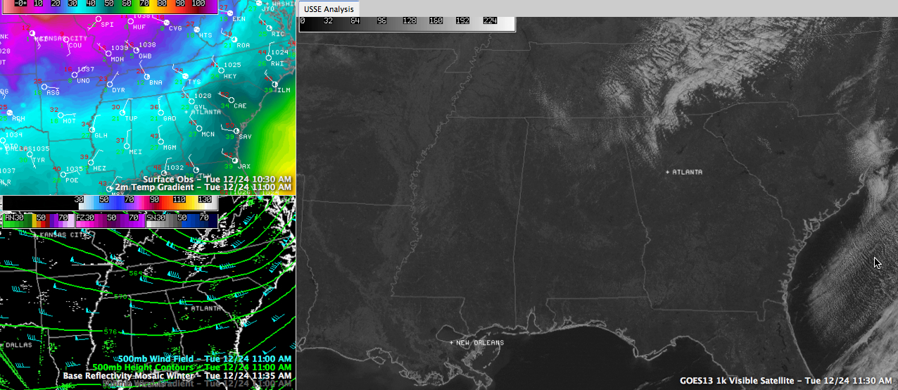
Click image to enlarge
It’s great to see the sun back across Central Alabama on this Christmas Eve. Unlike yesterday’s dreary and chilly conditions, today is bright and shiny like a pretty Christmas ornament.
A few clouds were over the Tennessee Valley, associated with a disturbance passing southeastward on the back side of the roller coaster of an upper trough over the Great Lakes. The clouds were falling apart as they evaporate in the very dry air over our state. The disturbance has been shaking out some snow flurries at places like Beckley WV and Jackson KY. It is snowing lightly this hour in Crossville TN.
The common element between yesterday and today is the chill. Temperatures are slowly recovering through the 30s this morning after morning lows in the 20s. It was 27F this morning at the Birmingham Airport, 29F at Tuscaloosa and 30F at Anniston.
Readings this afternoon will remain in the 30s in places like Hamilton, Arley, Oneonta and Fort Payne. Lower 40s will be common elsewhere in the I-59/20 corridors. You probably will have to travel to Troy to make the 50s. You can thank cold air advection for the chilly temperatures. That’s just a fancy way of saying that cold air is flowing into Alabama. High pressure between Memphis and Little Rock.
Santa will need his long johns tonight as he makes the rounds into Central Alabama. Much of the area will experience a hard freeze overnight as clear skies and calm conditions allow temperatures to fall like a rock. Readings will be in the teens over Northwest Alabama in parts of Marion and Winston as well as northern Fayette Counties. Places like Gadsden and Fort Payne will be near 20F. Lower 20s will be common across the rest of the area.
Bundle up as you head out for any last minute shopping or celebrations this afternoon and tonight.
A series of reinforcing cold fronts will arrive over the next five days, mostly likely on Thursday and Sunday. Temperatures will edge back into the 50s for the end of the week, but will fall back by Monday behind the bigger weekend cold front.



