


A sharp and deep upper level trough has its axis lined up from Duluth MN to Des Moines to Kansas City to Dallas this morning. Strong winds over 130 mph are howling on both sides of the trough. It would be a great morning to be flying from Shreveport to Detroit. You would have a 140 mph tailwind all the way!
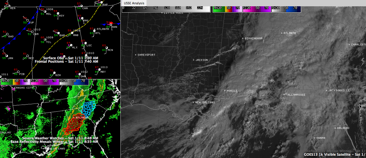
Click to enlarge for all sorts of weather stuff. Find the front, the sharp clearing, those dropping dewpoints and the line of storms.
In the lowest 5,000 feet, strong winds are lined up along I-85, with a maximum over North Georgia. This low level jet has transported rciher Gulf air further northward than was expected, and dewpoints are 66F at Montgomery and Dothan and 67F at Evergreen. Even in Atlanta, the dewpoint was 63F last hour.
The prefrontal surface trough is now lined up just east of I-65. It is driving an area of rain and thunderstorms across the southeastern half of Alabama.
The actual cold front is now entering Northwest Alabama. Up US-280 from Columbus GA, where the dewpoint is 67F, you find a 59F dewpoint at Alex City, a 54F dewpoint at BHM and on up US-78 you find dewpoints of 50F at Tupelo to 43F at Memphis.
Clearing will occur quickly behind the rain area. Sunshine is already in full force across th enorthern two thirds of Mississippi extending to nearl yI-65 in Alabama.
The NWS will be clearing counties behind the main line of storms from the tornado watch over the next couple of hours. Chambers and Montgomery were just given an all clear. The Tornado Watch continues for Barbour, Bullock, Lee, Macon, Pike and Russell till 2:00 PM CST.



