


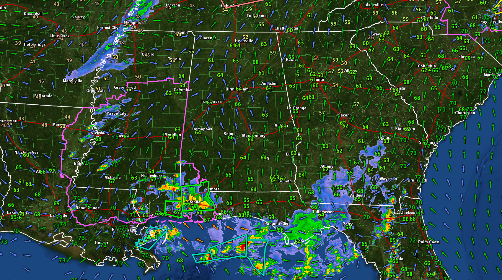
Here is an overview of the southeastern U.S. this afternoon, with the dewpoints prominently displayed and wind arrows to show the low level flow.
There has been a lot of discussion about convection along the coast cutting off the return flow of moisture into Central Alabama, but dewpoints are already 63F-67F across the area. The main flow we should be concerned with is the southerly flow over Louisiana. This is bringing rich Theta-E (heat content) air northward into a regional where skies have been sunny.
The western extent of last night’s outflow boundary that is responsible for this morning’s storms along the coast is lifting northward across southern Mississippi and coastal Alabama this afternoon. It intersects developing storms over southwestern Mississippi and northeastern Louisiana. This activity will push east and northeast this afternoon and evening.
There is a bit of convective inhibition over Central Alabama right now, which is the “cap” you hear us talk about sometimes. This is acting as a lid on the pot, but it will be gone with a little more sunshine. Speaking of sunshine, it is becoming sunnier by the minute across Central Alabama.
And as low level temperatures increase and mid-level temperatures decrease thanks to the approaching trough, the airmass will destabilize further. Already, CAPEs are running 1,000-1,500 j/kg across Central Alabama. and much higher to the southwest where the storms are initiating.
One of our key factors to watch is the Lifted Condensation Level, and those values are quite favorable for tornadoes across Alabama.
The bulk shear values are better than yesterday, so storm organization will not be a problem. Right now the low level helicity is weak, but this could strengthen as the surface low moves northeastward from western Louisiana.
The main storms will reach western Alabama between 3-4 p.m. But additional cells will move up from the southeast, reaching the Birmingham Metro around 4-5 p.m. Those should not be as strong. The main action could reach the Birmingham area between 5-7 p.m. and progress southeast during the evening.



