


A pretty potent little upper disturbance is rotating around the base of the big upper trough this morning. It triggered showers back to our northwest overnight, but they had a hard time working into Alabama as the airmass over our state was very dry. But that is changing this morning, and rising dewpoints are a signal of that. As the disturbance continues rounding the base of the trough, an area of showers was moving across North Central Alabama this morning. It will affect areas from Russellville and Hamilton down into northern Tuscaloosa County eastward as far south as Birmingham and northern Shelby County into Talladega, Clay and Randolph Counties as it moves eastward.
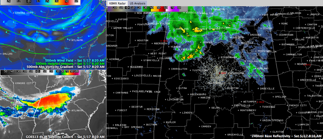
Additional lighter showers were along and south of I-20 from St. Clair County down into Clay County. These were also moving east and will Anniston, Heflin and Wedowee through late morning.
There is no thunder involved yet, although some can’t be ruled out, especially with the showers that are about to move through parts of the Birmingham area. In the heavier shower, rainfall could be near one quarter of an inch.
The main activity should be into Georgia by early afternoon. Temperatures are starting off in the 50s west of US-78/280, and are in the 40s east of there, with some 30s in the colder spots of Northeast Alabama. They will warm into the 60s by mid-morning and into the middle and upper 70s by afternoon as sunshine increases. This evening should be pleasant with readings falling through the 70s and 60s into the 50s by morning.
Clouds will increase again overnight as a second disturbance approaches. This one will have a little more moisture to work with and showers and maybe a little thunder will be possible through the pre-dawn hours and into the morning. Rainfall amounts will average around one quarter inch, mainly falling between midnight and noon. The surface front should sink further south as the disturbance passes, and northerly winds will signal the arrival of some cooler air. The cooler air and increased clouds will limit highs tomorrow to near 70F.



