


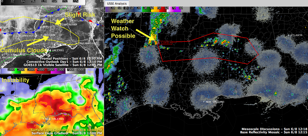
Showers and thunderstorms have developed across North Central Mississippi along US-82 as the outflow from an overnight thunderstorm complex that died out to the northwest pushed into our neighboring state. The airmass over Central Mississippi into West Central Alabama is very unstable, with CAPE values running 3,000-4,000 joules/kg. The thermodynamic profiles will lead to some very healthy thunderstorm updrafts once they reach a certain altitude. We are already seeing that on the radar. And there is sufficient wind aloft to allow them to organize. The cells are moving east toward Alabama.
As the storms intensify over the next hour or so, a severe thunderstorm watch is likely from northern Louisiana to western Alabama, says the Storm Prediction Center.
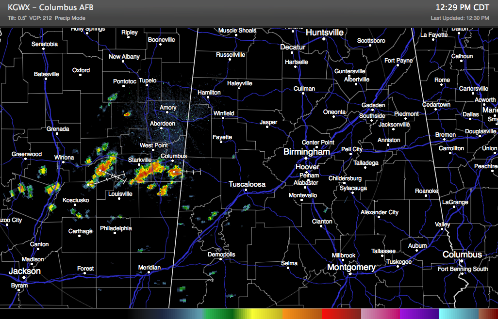
The cells are pushing into Pickens County right now, as seen from the Columbus radar.
Highs this afternoon will peak in the upper 80s for the most part.
You can see more showers and storms over western Arkansas and northeastern Texas. Those are associated with a disturbance that will continue east, bringing the complex of storms our way overnight tonight. The storms should reach western Alabama after midnight and reach I-65 in the hours just before sunrise. They could still be strong to severe at that point as well.



