


A thunderstorm dropping southeastward out of northern Jefferson County and a developing thunderstorm over the Irondale area are bringing heavy rain, lots of lightning/thunder and some gusty winds to the eastern part of Birmingham at this hour.
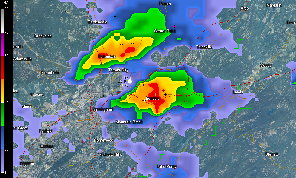
Both are pushing southeast or east southeast and appear to have peaked, but there could be a merger of the two remnant cells around I-20 and I-459. If the merger happens, you will see a rapid intensification and very heavy rainfall.
While they don’t look like they will become severe, it is still a good idea to be inside if they are in your vicinity.
Elsewhere in the state, the most intense storms are over South Central Alabama, near and south of US-80. They are dropping southward.
In eastern Mississippi west of Columbus, severe thunderstorms have grown in coverages and intensity and will be moving into western Alabama over the next couple of hours. In fact, one strong (not severe) storm is poised to move into northern Sumter and southern Pickens Counties shortly. It will pass between Geiger and Aliceville. It has lots of lightning. These storms are moving generally northeast.



