An upper level system passing through the Rockies today has closed off into the upper level low we have been talking about. It is centered between Kansas City and St. Louis. An upper level trough is located over Arkansas. It is triggering scattered intense thunderstorms tonight across Arkansas and northeastern Louisiana.
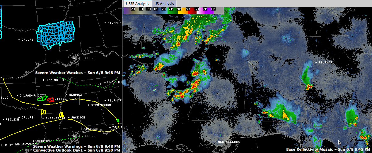
There are a couple of severe thunderstorm warnings across southern Arkansas and northern Louisiana. The northeastern Louisiana severe storm is moving into the Delta near Rolling Fork north of Vicksburg. There was a tornado warning in effect for the Texarkana area, where a funnel cloud was sighted and radar picked up persistent rotation. There is now a tornado warning in the Little Rock area for a possible tornado wast of Bryant.
A severe thunderstorm watch is in effect across southern Arkansas, northern Louisiana into Mississippi.
The storms over northeastern Louisiana are part of an MCV (mesoscale convective vortex) that is expected to track east northeast overnight, pushing into Alabama an hour or two after midnight and tracking across areas mainly along and north of I-20 through the early morning hours. It should start weakening before sunrise.
The SPC maintains a slight risk severe weather outlook and we agree that these storms could produce scattered severe weather reports, including damaging winds and hail through the predawn hours.