


Here is an update on the Alabama weather situation on this Sunday afternoon:

This morning, we noticed a boundary, subtle but fairly evident on radar returns, moving southward across Central Alabama. This boundary triggered a couple of early morning storms over West Central Alabama. Those storms quickly died without the fuel of instability. The disparity in cloudiness ahead and behind the subtle boundary set up a quasi-frontal system and the difference in heating has triggered more showers and storms this afternoon. Some of them have been severe, although the only severe weather reported so far has been a few trees downed in Tallassee.
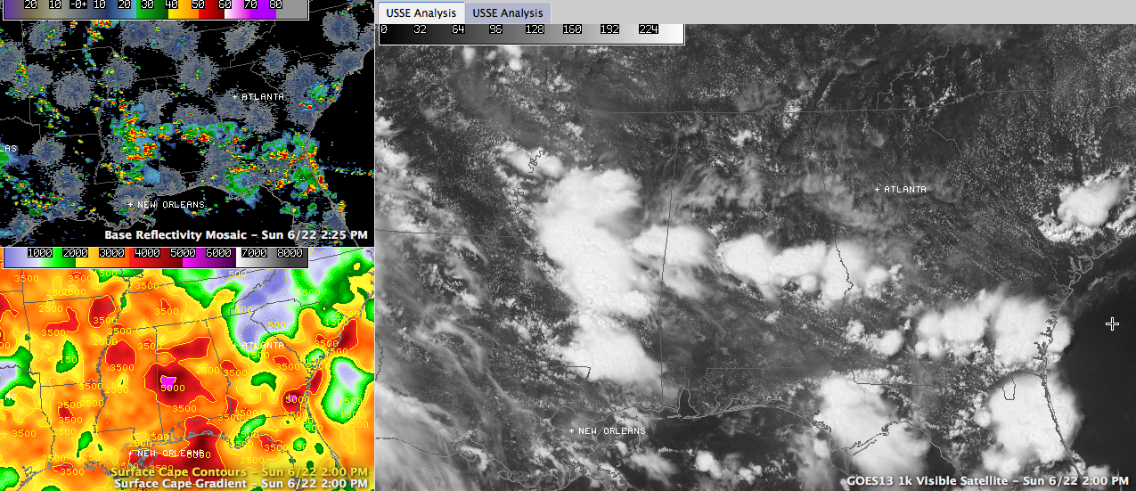
With some drier air aloft, there is a higher potential for downbursts, those sudden violent downdrafts that can develop with strong storms. Downbursts can produce damaging winds. Most of the storms have been south of US-82/I-85, although some isolated ones have been developing north of there. Be alert to any storms that develop this afternoon, as they may produce those damaging winds, torrential rains and deadly lightning.
Highs will top out in the upper 80s to near 90F. Lows tonight will drop to near 70F.
THE WEEK AHEAD: By tomorrow morning, a strong upper level disturbance will be marching east across Kansas. With the upper high out of the picture, the disturbance will begin to carve out a trough across the eastern part of the United States, including Alabama. Troughs means cooler and wetter weather as showers and storms can more readily form. Rain chances during the days will average between 50 and 60 percent each day through Thursday before they start backing off for the weekend. Timing the disturbances to give some idea of when to expect the best concentrations of showers and storms is hard to do at best. One would expect the best chances for rain and storms will be in the afternoons, but in fact, rain chances will be high nearly every period through Thursday night.
High temperatures will back off into the upper 80s through much of the week ahead, but lows will chug along right around 70F.
HIGH PRESSURE RETURNS: The old familiar high pressure will return by the weekend stifling shower and thunderstorm development and pushing the mercury back into the lower 90s again. This will set the stage for a typically hot run at the fourth of July.



