


Thunderstorms formed over eastern Mississippi late this morning morning and they have slowly been marching eastward toward the Alabama border. Some of them have made it into Northwest Alabama now, including Marion County. and are within striking distance of Alabama’s Sumter, Pickens and Lamar Counties.
Here is the radar just after 3 p.m.:
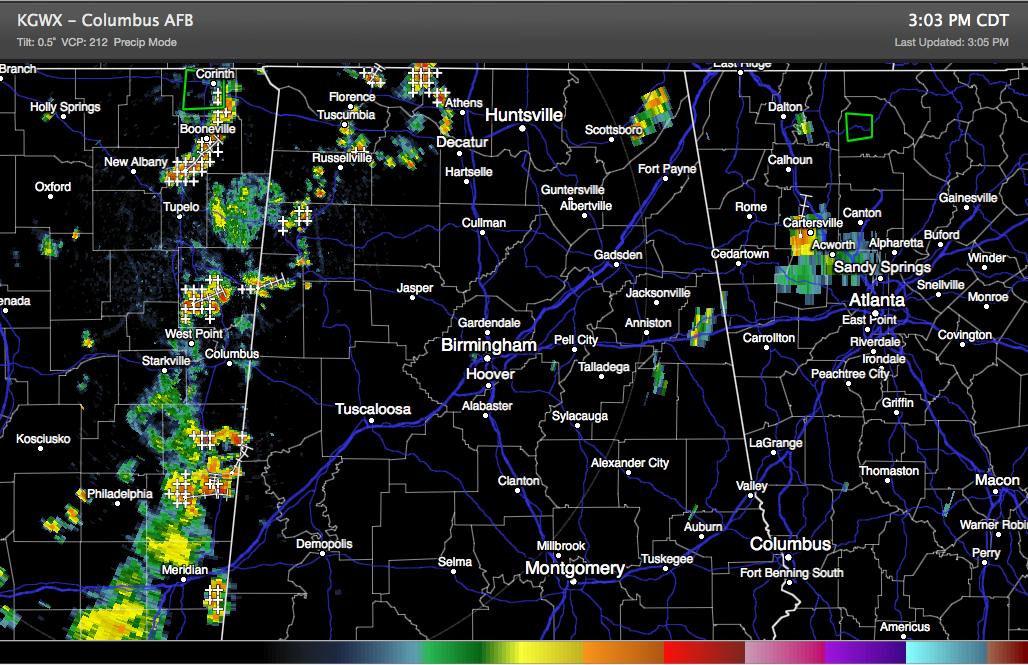
The storms will continue moving east slowly. They should remain below severe limits, since instability values over Alabama are a little lower.
For awhile, storms over western Georgia appeared to be moving northwest, and it looked like our state was under siege from the left and the right. But the storms over Georgia started moving northeast as well, in the broad southwesterly flow aloft.
A strong upper level trough now to our west will move our way tomorrow, increasing shower and thunderstorm chances.



