


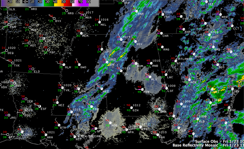
A band of mixed precipitation is pushing east across the state tonight. Travel impacts this morning will be minor at worst over the northern third of the state: maybe some light accumulations on grassy areas or cars, and a few icy spots on bridges where the snow does accumulate.
Temperatures at midnight are in the lower and middle 40s in the I-20 corridor with 30s over the Tennessee Valley. It was 37F at Tupelo with a mix. Muscle Shoals had 37F with a light mix.
LOOKING UP FOR THE WEEKEND: The sun should reappear today, with skies becoming clear by mid to late afternoon. High temperatures will be in the upper 40s in the I-20 corridor, where the sun will take a little more time to pop out. It will actually be slightly warmer in the northwest, where there will be a longer duration of sunshine. Lows tonight will be in the middle 30s with a few freezing readings sprinkled across the area.



