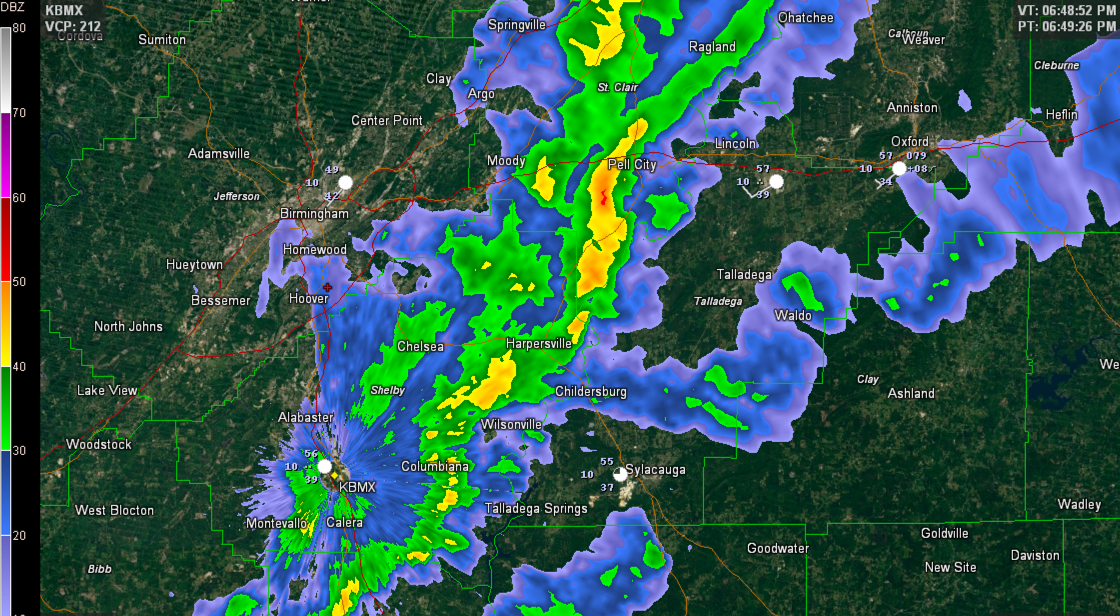
Our line of strong storms is weakening now. It extends from Pell City to Harpersville to Columbiana.
Winds gusted to 31 mph at the Shelby County Airport in Calera.
More severe thunderstorm warnings will not be issued unless the storms re-intensify.


Published on: January 26, 2015 at 12:29 AM
Our line of strong storms is weakening now. It extends from Pell City to Harpersville to Columbiana.
Winds gusted to 31 mph at the Shelby County Airport in Calera.
More severe thunderstorm warnings will not be issued unless the storms re-intensify.

 November 5, 2026 at 5:01 AM
RADAR CHECK: Showers continue this morning across parts of Southeast Alabama ahead of a surface front; to north there is a dense fog advisory for much of North, West, and Southwest Alabama where visibilities are very limited. Showers and fog … Continue reading
READ MORE
 November 4, 2026 at 2:54 PM
RADAR CHECK: Showers and a few thunderstorms are lined up across Alabama from near Scottsboro to Birmingham to Selma to Jackson at mid-afternoon. This is along a cold front which is moving eastward. With weakening wind fields and dynamic support, … Continue reading
READ MORE